
Test Pit Investigations for Data Center Earthwork Planning
Explore how test pit investigations provide critical data for data center earthwork planning, helping identify buried obstructions, evaluate fill quality, and de-risk site development. Learn the benef
The Role of Test Pits in Geotechnical Site Characterization
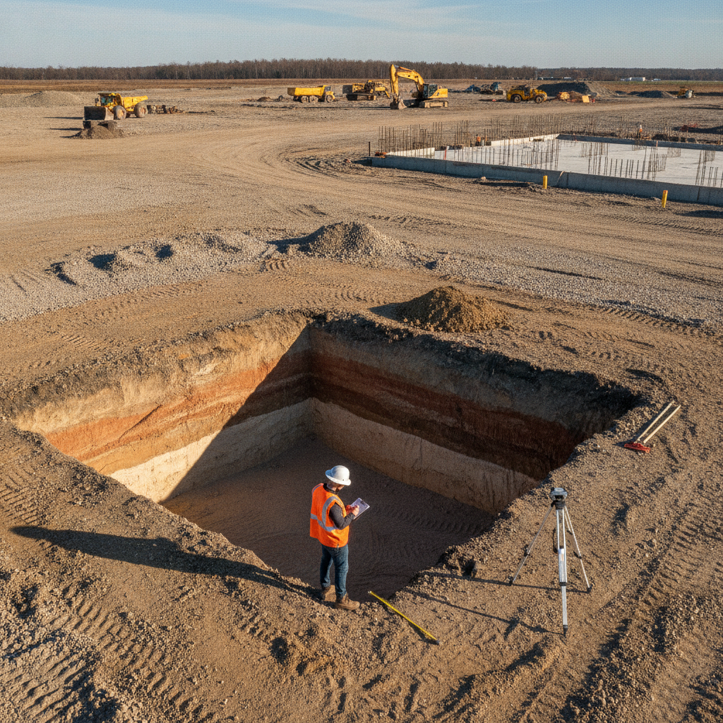
A test pit is an open excavation, typically dug with a backhoe or excavator, that allows for direct, visual examination of subsurface soils in their natural state. Unlike the small-diameter samples recovered from a soil boring test, a test pit exposes a continuous vertical profile of the soil, often several feet wide. This allows a Geotechnical engineer or geologist to observe critical details that are easily missed in borings, such as the thickness and continuity of soil layers, the presence of thin sand seams or clay lenses, soil structure (fabric), and the nature of contacts between different strata. This direct visual access is a powerful tool for building an accurate conceptual site model. It helps verify and correlate the findings from soil borings, providing a more complete picture of site heterogeneity. For large data center campuses, a strategic program of test pits can rapidly characterize vast areas, informing the overall civil engineering strategy for grading and foundation support. This initial phase of site engineering services is critical for identifying potential challenges before detailed design commences.
Identifying Buried Obstructions and Unsuitable Fill
Comparison: Test Pits vs. Soil Borings for Data Center Sites
| Feature | Test Pit Investigation | Standard Soil Boring (SPT) |
|---|---|---|
| Investigation Depth | Shallow (typically 8-15 feet), limited by excavator reach and safety regulations. | Deep (can extend hundreds of feet), suitable for deep foundation analysis. |
| Subsurface Visibility | Excellent. Provides a wide, continuous view of soil layers, structure, and color. | Limited. Relies on small, discrete samples recovered from the borehole. |
| Debris/Obstruction Detection | High. Excellent for identifying buried foundations, utilities, and large debris. | Low. Can easily miss obstructions located between boring locations. |
| Bulk Sampling Capability | Excellent. Allows for the collection of large, disturbed samples for lab testing (e.g., Proctor). | Poor. Only small samples are collected, unsuitable for tests requiring large volumes. |
| Groundwater Observation | Good. Allows direct observation of seepage rates and entry points in real-time. | Good. Provides a stabilized water level reading over time (piezometer). |
| In-Situ Strength Testing | Limited. Visual assessment and some field tests (e.g., pocket penetrometer). | Excellent. Standard Penetration Test (SPT) provides quantitative N-values for engineering analysis. |
One of the primary advantages of a test pit investigation is its unparalleled ability to detect buried obstructions and characterize undocumented fill. Data center sites, especially those in developed areas, may hide remnants of previous construction, such as old foundations, abandoned utility lines, concrete rubble, or other debris. A standard soil boring can easily miss such objects. Hitting a single concrete slab with a drill rig might be noted as “refusal,” but a test pit can expose its full extent and nature, informing the site plan design and removal strategy. Similarly, test pits are essential for evaluating the quality and extent of existing fill material. The investigation can reveal if the fill is well-compacted and suitable for supporting new structures or if it contains organic materials, construction debris, or other deleterious substances that would require removal and replacement. This information is vital for accurate earthwork cost estimating and for preventing long-term issues like differential settlement, which is a critical risk for data center superflat floors and sensitive equipment. Proper characterization is a key component of the overall land development process.
Evaluating Existing Fill for Reuse and Compaction
The economic and logistical success of a data center’s earthwork program often hinges on the ability to reuse on-site soils. Test pits are the most effective method for obtaining large, representative bulk samples of existing fill and native soils for laboratory testing. These samples are used for a variety of analyses, including moisture content, gradation, and Proctor tests (which determine the optimal moisture content and maximum dry density for compaction). The results of this laboratory testing directly inform the civil engineering specifications for site grading. If on-site soils are deemed suitable, the project can save substantially on the costs of importing engineered fill and disposing of excess material. However, the suitability criteria and required testing protocols for fill materials can be complex. Earthwork specifications and fill quality requirements vary by jurisdiction, and every project team should confirm the applicable standards with the local, state, regional, and federal authorities that hold review authority over the site. This due diligence during the permitting phase prevents costly rework during construction.
Direct Observation of Soil Fabric and Groundwater Seepage
A test pit provides a unique window into the hydrogeological conditions of the near-surface environment. As the pit is excavated, engineers can directly observe the depth of the water table and note how groundwater seeps into the excavation—whether through discrete sand layers, fractures, or more generally. This real-world observation is invaluable for designing temporary dewatering systems for foundation and utility construction and for planning permanent stormwater management and under-drain systems. Furthermore, the exposed face of the pit allows for detailed examination of the soil fabric. Features like mottling (indicating fluctuating water tables), root traces, desiccation cracks, and other structural elements become visible. This information helps the Geotechnical engineer understand the soil’s history and in-situ behavior, which influences recommendations for foundation design, slope stability, and the design of subsurface drainage design elements. These observations provide a level of detail that complements the quantitative data from laboratory testing.
Safety Protocols and Shoring Requirements for Test Pits
Excavation safety is paramount during any test pit investigation. All operations must comply with Occupational Safety and Health Administration (OSHA) standards for excavations. For pits deeper than five feet, protective systems such as shoring, shielding (trench boxes), or sloping/benching of the sidewalls are typically required to prevent collapse, unless the excavation is made entirely in stable rock. The specific requirements depend on the soil type and depth of the excavation. A qualified Professional Engineer or competent person must assess the site conditions to determine the appropriate safety measures. The process involves careful planning, including locating and marking all underground utilities before digging begins. The construction administration team must ensure that all personnel on site are aware of the hazards and follow strict safety protocols, including maintaining a safe distance from the edge of the excavation and providing safe means of entry and egress.
The RSP Engineers Process for Test Pit Investigations
At RSP Engineers, we follow a systematic approach to ensure our test pit investigations deliver maximum value and actionable data for our data center clients. Our process is designed to integrate seamlessly with the overall project lifecycle, from initial due diligence to final design. Phase 1: Desktop Analysis and Planning: We begin by reviewing available geologic maps, historical aerial photographs, and previous site reports. We then develop a site-specific health and safety plan and a detailed test pit location plan, targeting areas of greatest uncertainty or concern based on the proposed site plan design. Phase 2: Field Execution: Our field team, led by an experienced Geotechnical engineer or geologist, oversees the excavation. We coordinate with utility locators and excavation contractors, meticulously log the soil stratigraphy, photograph all pit walls, and collect representative bulk and discrete samples for testing. Phase 3: Laboratory Testing: Samples are transported to a certified laboratory for a testing program tailored to the project’s needs. This may include moisture content, particle size analysis, Atterberg limits, and Proctor compaction tests to inform the earthwork specifications. Phase 4: Reporting and Recommendations: We synthesize all field and laboratory data into a comprehensive Geotechnical soil report. This report provides clear recommendations for site preparation, fill placement and compaction, foundation design, and groundwater management, providing the project team with the data needed to move forward with confidence.
Common Challenges in Test Pit Programs
Even with careful planning, test pit investigations can encounter challenges. Site access for heavy equipment like excavators can be a significant constraint, especially on heavily wooded or steeply sloped sites. Encountering an unexpectedly high groundwater table can make excavation difficult and unsafe, requiring dewatering measures to proceed. The discovery of contaminated soils or hazardous materials is another potential issue, which would halt the investigation and trigger specific environmental protocols and regulatory reporting. Finally, proper backfilling and compaction of the test pits after the investigation is critical to ensure the site is left in a stable condition, preventing future settlement issues in those locations.
Partner with RSP for Your Next Mission-Critical Project
Planning and executing a successful data center project requires a deep understanding of the ground it’s built on. At RSP Engineers, our team provides expert Geotechnical Engineering and site engineering services to help you navigate the complexities of subsurface investigation. We leverage tools like test pit investigations to de-risk your project, optimize your earthwork strategy, and provide a solid foundation for your critical infrastructure. From initial due diligence and permitting to detailed design and construction administration, we are your trusted partner. Contact us today to discuss how we can support your next project.
Conclusion
Test pit investigations are a powerful, cost-effective method for gaining critical insights into near-surface soil and groundwater conditions. For data center projects, where earthwork can represent a significant portion of the budget and schedule, the high-resolution data from test pits is invaluable. By complementing traditional soil boring test programs, they enable project teams to identify risks early, make informed decisions about reusing on-site materials, and develop a more accurate and reliable site plan design. A well-planned geotechnical investigation that includes test pits is a fundamental step in delivering a successful mission-critical facility on time and within budget.
FAQs
-
The depth of a test pit is primarily limited by the reach of the excavation equipment (typically a backhoe or excavator) and safety regulations. Most test pits are between 8 and 15 feet deep. Excavations deeper than 20 feet are generally not feasible or cost-effective with standard equipment and would require specialized shoring and safety measures, making soil borings a better alternative for greater depths.
-
Test pits are most advantageous when the primary concerns are related to near-surface conditions. They are superior for identifying the extent of undocumented fill, locating buried debris or old foundations, visually assessing soil stratigraphy over a wide area, and obtaining large bulk samples for earthwork compaction testing. They are ideal for large, flat sites where shallow foundation systems are anticipated.
-
Absolutely. One of the key benefits of a test pit is the ability to collect large, disturbed bulk samples. These samples are ideal for a range of laboratory tests, including moisture-density relationship (Proctor) tests, particle-size analysis (gradation), Atterberg limits, and classification. This data is essential for developing the project’s civil engineering specifications for fill and compaction.