
Groundwater Monitoring for Data Center Developments
Discover why comprehensive groundwater monitoring is critical for data center development. Learn about dewatering, buoyancy, and stormwater design from the civil engineering experts at RSP Engineers.
The Role of Groundwater in Site Feasibility and Design
Understanding groundwater conditions early in the due diligence process is essential for making informed decisions. A preliminary Geotechnical Engineering investigation provides the first glimpse into subsurface conditions, but a dedicated monitoring program provides the detailed data needed for robust design. This data directly influences critical site development decisions, including the placement of buildings, the depth of foundations, the design of underground utility corridors, and the feasibility of subterranean structures like basements or fuel tanks. A comprehensive understanding of groundwater helps the civil engineering team assess risks associated with soil stability, excavation safety, and potential construction delays. For data centers, which have zero tolerance for structural movement or water intrusion, this information is paramount. It allows engineers to design appropriate foundation systems—whether shallow footings or deep piles—and to anticipate the level of effort required for site work, ensuring the structural integrity of a facility designed to operate for decades.
Establishing a Groundwater Monitoring Program
Groundwater Monitoring Data Application Matrix
| Groundwater Condition | Primary Risk | Design & Construction Implication |
|---|---|---|
| Shallow Seasonal High Water Table | Flooded excavations; limited infiltration capacity; long-term buoyancy. | Requires extensive dewatering; precludes infiltration BMPs; necessitates robust waterproofing and foundation design to resist hydrostatic uplift. |
| Perched Water Lens | Localized, often seasonal, excavation instability. | Can often be managed with temporary, localized dewatering (e.g., sump pumps). May still impact shallow utility installation. |
| Deep Regional Aquifer | Low risk for typical foundations and utilities. | Standard foundation and stormwater designs are generally feasible. Deep structures would require significant investigation. |
| Artesian Conditions (Pressurized Aquifer) | Ground heave; potential for uncontrolled water flow into excavations. | Requires specialized dewatering and pressure relief systems. Poses significant construction risk and requires expert geotechnical design. |
| Fluctuating Levels Near Surface | Unpredictable construction conditions; potential for post-construction settlement or heave. | Requires long-term monitoring to establish a reliable design basis. Design must be conservative to handle the highest anticipated levels. |
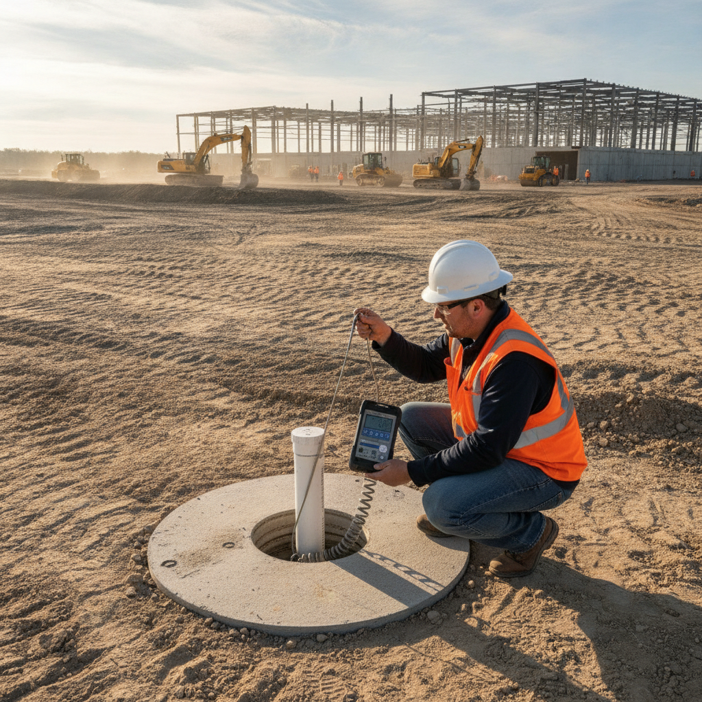
A successful groundwater monitoring program goes beyond a single snapshot in time. It involves the strategic installation of monitoring wells and piezometers to collect data over a period that captures potential seasonal variations. Monitoring wells are typically screened across the water table to allow for direct measurement of its elevation, while piezometers are designed to measure the piezometric pressure at a specific depth, which is crucial in identifying artesian conditions. The goal is to establish the Seasonal High Water Table (SHWT), which represents the highest level the groundwater is likely to reach during the wettest time of year. This long-term data is far more valuable than the single-point readings taken during an initial soil boring test. A short-term reading might miss critical fluctuations, leading to a design based on incomplete or misleading information. A proper monitoring program, guided by a qualified Geotechnical engineer, provides the design team with a reliable baseline for all subsequent site engineering services, from foundation design to stormwater modeling.
Differentiating Perched Water Tables from Regional Aquifers
A critical aspect of groundwater analysis is distinguishing between different types of subsurface water. A perched water table is a localized body of groundwater that sits above a relatively impermeable layer (an aquitard), separated from the larger, underlying regional aquifer. These perched zones can be deceptive; they may appear during wet seasons and disappear during dry periods, and they can often be managed with localized dewatering efforts. In contrast, the regional aquifer is a much larger, more persistent body of water. Encountering the regional aquifer at a shallow depth presents a significantly greater challenge for drainage design and construction. Attempting to dewater a regional aquifer can be like trying to empty a lake with a bucket—often impractical and extremely expensive. Correctly identifying the nature of the groundwater is fundamental to developing a viable site plan design and avoiding catastrophic miscalculations during construction.
Implications for Excavation, Dewatering, and Buoyancy
High groundwater levels present three major construction challenges: excavation instability, the need for extensive dewatering, and long-term hydrostatic uplift (buoyancy). Saturated soils are often unstable, requiring shoring or sloped excavations to prevent collapse, which increases the construction footprint and cost. Active dewatering systems, such as well points or deep wells, are often necessary to lower the water table and create a safe, dry working environment. These systems require continuous operation and significant energy consumption, adding to the project budget. Dewatering and discharge permitting requirements vary by jurisdiction, and every project team should confirm the applicable standards with the local, state, regional, and federal authorities that hold review authority over the site. Beyond construction, once a subterranean structure is in place, it must be designed to resist the constant upward pressure from groundwater. This buoyant force can be immense, capable of lifting even heavy concrete structures if not properly accounted for with robust foundation design, anchors, or pressure relief systems. This is a critical consideration for any construction administration plan.
Groundwater’s Influence on Stormwater Management Systems
Modern stormwater management regulations often encourage or require the use of infiltration-based Best Management Practices (BMPs), such as infiltration basins, permeable pavements, and bio-retention swales. These systems work by allowing stormwater to soak into the ground, recharging aquifers and reducing runoff. However, their effectiveness is entirely dependent on having adequate separation between the bottom of the BMP and the seasonal high water table. If groundwater monitoring reveals a shallow water table, infiltration is not a viable option. This forces the drainage design toward other solutions, such as lined detention or retention ponds, or complex underground detention vaults. These alternatives often consume more surface area, are more expensive to construct, and may face a more complex permitting process under programs like the federal NPDES. A qualified Drainage engineer near me can use accurate groundwater data to select the most appropriate and compliant stormwater strategy from the outset.
How RSP Engineers Manages Groundwater Investigations
At RSP Engineers, we integrate groundwater assessment into our civil engineering process from day one. Our approach begins with a thorough review of existing geological and hydrogeological data to inform a site-specific investigation plan. We collaborate closely with Geotechnical Engineering partners to oversee the installation of monitoring wells and establish a data collection protocol that aligns with the project’s specific risks and timeline. Our team of experienced Civil Engineers doesn’t just receive a Geotechnical soil report; we actively interpret the data to inform a practical and resilient site plan design. We translate raw water level readings into actionable recommendations for foundation design, utility routing, stormwater management strategies, and construction sequencing. This proactive, integrated approach helps our clients mitigate subsurface risks, avoid costly change orders, and deliver a more reliable mission-critical facility.
Common Challenges in Groundwater Assessment
Even with a well-defined plan, groundwater assessment can present challenges. Project timelines may create pressure to shorten the monitoring period, risking an incomplete picture of seasonal fluctuations. Site access constraints can limit the ideal placement of monitoring wells, requiring interpolation and engineering judgment. During drilling for a soil boring test, crews may encounter unexpected subsurface obstructions like rock or debris, complicating well installation. Furthermore, interpreting the data requires expertise. Differentiating between a temporary perched lens and the regional aquifer, or identifying subtle artesian pressures, is a complex task. An inexperienced team might misinterpret the data, leading to a design that is either overly conservative and expensive or, worse, inadequate to handle the true site conditions. Overcoming these challenges requires a team with deep field experience and a commitment to thorough due diligence.
Partner with RSP for Mission-Critical Site Development
Navigating the complexities of subsurface conditions requires a partner with proven expertise in mission-critical land development. The team at RSP Engineers provides comprehensive site engineering services, from initial due diligence and Geotechnical Engineering coordination to final permitting and construction support. We specialize in identifying and mitigating the hidden risks that can derail data center projects. Don’t let subsurface surprises compromise your investment. Our integrated approach ensures that your facility is built on a solid, stable, and dry foundation.
Conclusion: Proactive Monitoring for Project Success
In conclusion, a thorough groundwater monitoring program is an indispensable part of due diligence and design for data center developments. It provides the critical data needed to manage risks associated with excavation, dewatering, foundation buoyancy, and stormwater management. By investing in a proactive understanding of subsurface conditions, developers can avoid costly construction delays, prevent long-term structural issues, and ensure the resilience of their mission-critical infrastructure. This level of foresight is a hallmark of successful civil engineering and sound land development strategy.
FAQs
-
Ideally, groundwater should be monitored long enough to capture a full wet season to reliably establish the Seasonal High Water Table (SHWT). While project schedules can be tight, a minimum of several months of monitoring is highly recommended over relying on a single reading. The specific duration depends on regional climate patterns and project risk tolerance.
-
A monitoring well is typically designed with a long screen to intersect the water table, allowing for measurement of the static water level. A piezometer has a very short, targeted screen and is used to measure the piezometric or pressure head at a specific point within the aquifer, which is essential for identifying artesian conditions or vertical groundwater gradients.
-
While it rarely stops a project entirely, encountering unexpectedly high groundwater can make a site economically unviable. The costs associated with extensive dewatering, specialized foundation design, and complex stormwater management can significantly inflate the budget. Early detection allows a developer to make a go/no-go decision before committing significant capital.