
Existing-Condition Drainage Studies for Data Center Sites
Learn why a thorough existing-condition drainage study is critical for data center development. RSP Engineers explains how to establish a baseline for stormwater management and permitting.
Establishing the Pre-Development Hydrologic Baseline
The primary goal of an existing-conditions drainage study is to establish the pre-development hydrologic baseline. This baseline is a detailed snapshot of how stormwater behaves on and around the site in its current state. It quantifies key metrics such as peak discharge rates, runoff volumes, and flow paths for various storm events (e.g., 25-year, 100-year storms). This data is not merely academic; it forms the legal and technical benchmark for the entire site development project. Regulatory agencies nationwide require that post-development stormwater runoff does not adversely impact downstream properties or receiving waters. In most cases, this means the post-development peak discharge rate must be less than or equal to the pre-development rate. The existing-conditions study provides the definitive pre-development numbers that the proposed drainage design must meet. Without this baseline, it is impossible to demonstrate zoning compliance or obtain the necessary permits for construction.
Topographic and Boundary Survey: The Foundation of Drainage Analysis
Key Data Points in an Existing-Conditions Drainage Report
| Data Point | Description | Implication for Data Center Design |
|---|---|---|
| Peak Pre-Development Discharge Rate | The maximum rate of stormwater runoff (in cubic feet per second) from the site for a specific storm event in its current condition. | Sets the maximum allowable discharge rate for the post-development design, directly influencing the size of detention/retention ponds. |
| Pre-Development Runoff Volume | The total volume of water that runs off the site during a specific storm event. | Determines the required storage volume for stormwater ponds and other BMPs to prevent downstream impacts. |
| Existing Conveyance System Capacity | The maximum flow that existing pipes, culverts, and channels can handle without overtopping. | Identifies system bottlenecks that must be upgraded and informs the design of new on-site conveyance infrastructure. |
| 100-Year Floodplain Elevation (FEMA) | The water surface elevation of a flood that has a 1% chance of being equaled or exceeded in any given year. | Dictates the minimum finished floor elevation for the data center and other critical infrastructure to prevent flood damage. |
| Seasonal High Groundwater Table | The highest level to which groundwater is expected to rise during the year. | Constrains the depth of excavations and the feasibility of underground utilities and infiltration-based stormwater systems. |
| Hydrologic Soil Group (HSG) | A classification of soils based on their infiltration and runoff potential (Group A: high infiltration, Group D: low infiltration). | A primary input for hydrologic models that dictates the selection of appropriate stormwater management strategies. |
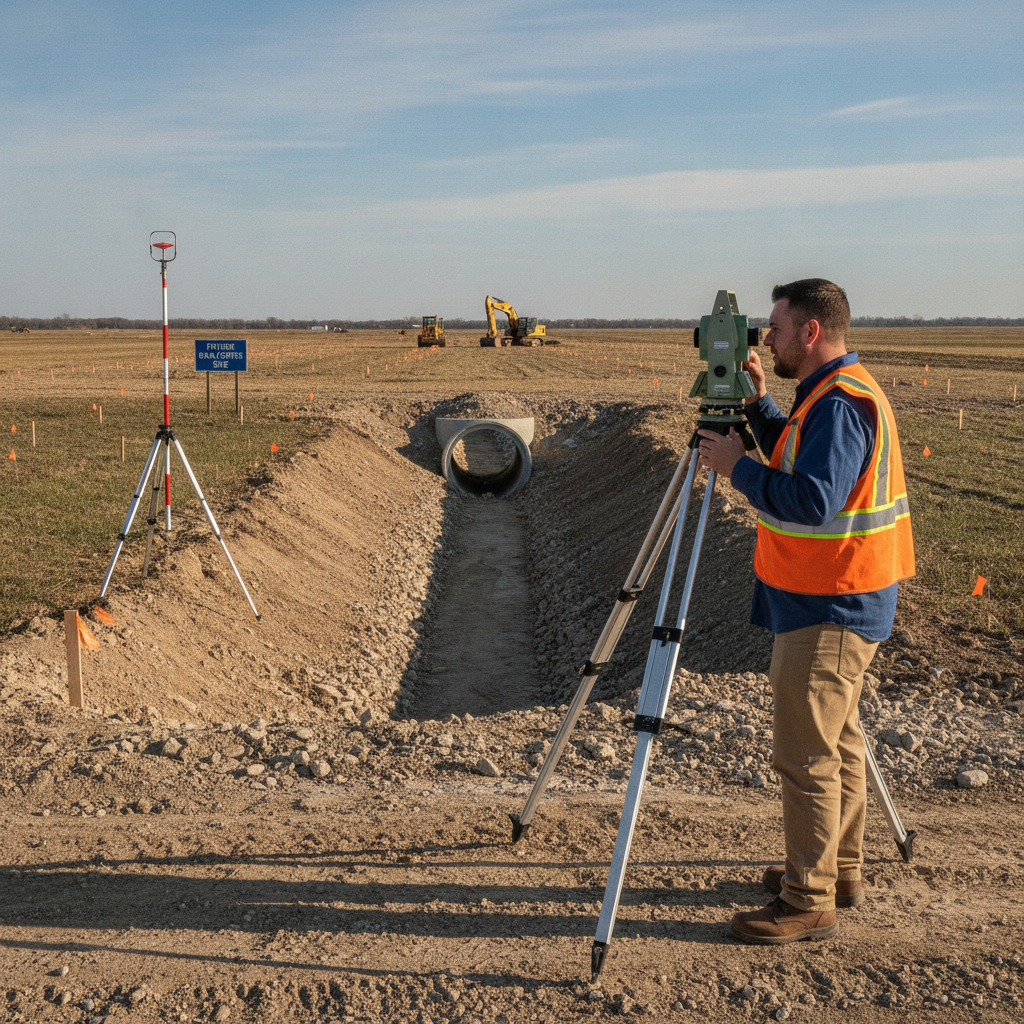
A high-precision topographic and boundary survey is the starting point for any credible drainage study. This survey maps the physical reality of the site, capturing ground elevations, contours, and the location of all existing features. Modern surveys often combine traditional ground crews with advanced technologies like LiDAR (Light Detection and Ranging) and aerial photogrammetry to create a detailed three-dimensional model of the terrain. This model is the canvas upon which all subsequent hydrologic modeling is built. The survey must identify and locate all features relevant to drainage, including existing buildings, pavement, ditches, swales, culverts, wetlands, and water bodies. The accuracy of this data is critical, as even minor variations in elevation can significantly alter calculated flow paths and watershed boundaries. A thorough survey prevents costly design revisions and ensures the resulting drainage analysis accurately reflects real-world conditions.
Watershed Delineation and Off-Site Contributions
A data center site does not exist in a vacuum. It is part of a larger watershed, and understanding how water flows onto the property from adjacent lands is just as important as understanding how it flows off. The drainage study involves delineating the full contributing drainage area—the total land area that sheds stormwater to the site’s discharge points. This often includes significant off-site areas, especially for large parcels. Failing to account for off-site flows can lead to severely undersized stormwater infrastructure, resulting in on-site flooding and potential liability for downstream impacts. Civil engineers use the topographic data to trace watershed boundaries and calculate the acreage of these contributing areas. This information is then used in hydrologic models to simulate the total volume and rate of runoff the site must manage, forming a key component of the overall stormwater management strategy.
Identifying and Assessing Existing Stormwater Infrastructure
Many potential data center sites, particularly brownfield or previously developed parcels, contain existing stormwater infrastructure. A crucial part of the study is to conduct a detailed inventory and condition assessment of these assets. This includes locating all pipes, inlets, manholes, culverts, and channels, and documenting their size, material, and invert elevations. The field investigation should also assess the structural integrity and hydraulic capacity of each component. This assessment determines whether existing infrastructure can be repurposed or if it must be replaced. An undersized or deteriorating culvert, for example, could create a major bottleneck and flooding hazard. Design standards for these structures and their required capacity often vary by jurisdiction, and it is essential to confirm all applicable criteria with the local, state, regional, and federal authorities. This due diligence protects the project from inheriting costly problems and ensures the final design meets all building code compliance requirements.
Analyzing Receiving Waters and Legal Outfalls
Every site must have a legal and adequate outfall—a point where stormwater can be discharged without causing adverse impacts. The study identifies all potential outfalls, such as municipal storm sewer systems, county drains, rivers, or streams. The analysis then extends downstream to evaluate the capacity of these receiving waters. A downstream capacity analysis may be required to prove that the proposed development will not overwhelm the existing system or cause flooding on other properties. Furthermore, the study must identify any environmentally sensitive features, such as wetlands, floodplains, or protected habitats. Discharging into or altering these areas often triggers stringent permitting requirements under federal programs like the Clean Water Act. Identifying these constraints early allows the project team to develop a site plan that avoids or minimizes impacts, streamlining the agency review process.
Geotechnical Investigation and Soil Permeability Analysis
The site’s subsurface conditions play a vital role in its drainage characteristics. A Geotechnical Engineering investigation, including soil borings and laboratory testing, provides essential data on soil types, permeability, and the depth of the seasonal high groundwater table. This information is used to determine the site’s hydrologic soil group (HSG), a classification that directly influences how much rainfall infiltrates into the ground versus becoming surface runoff. Highly permeable soils (like sands) may support infiltration-based stormwater solutions, such as basins or permeable pavements. Impermeable soils (like clays) will require different strategies, such as detention ponds, to manage runoff. The geotechnical soil report is a critical input for the drainage design, informing the selection and sizing of Best Management Practices (BMPs) and ensuring the proposed system will function as intended.
RSP Engineers’ Approach to Existing-Conditions Analysis
At RSP Engineers, our process for conducting an existing-conditions drainage study is systematic and thorough, ensuring no detail is overlooked. We begin with a comprehensive desktop analysis, reviewing available GIS data, FEMA flood maps, soil surveys, and historical aerial imagery to build a preliminary understanding of the site. This is followed by close coordination with a professional surveyor to obtain precise topographic and boundary data. Our engineers then conduct a detailed field reconnaissance to verify desktop findings, locate and assess existing infrastructure, and identify any unmapped drainage features. Using this collected data, we develop a calibrated hydrologic and hydraulic model to accurately simulate the site’s existing drainage patterns. The final deliverable is a comprehensive report that not only documents the baseline conditions but also provides actionable recommendations to inform the subsequent site plan design and guide the project through the permitting process.
Common Challenges in Existing-Conditions Drainage Studies
Even with a methodical approach, our team often encounters challenges that require expert problem-solving. Inaccurate or outdated municipal records can make it difficult to verify the capacity and connectivity of downstream storm sewer systems. Undocumented off-site flow from neighboring properties can introduce unexpected volumes of water that must be managed. In other cases, we may find that the legal outfall is an undersized or poorly maintained ditch, requiring complex negotiations with adjacent landowners or public agencies. Conflicting survey data or discrepancies between historical plans and current conditions are also common. Navigating these issues requires a deep understanding of civil engineering principles and experience with the practical realities of land development. Proactively identifying and addressing these challenges during the study phase prevents them from becoming major obstacles during construction.
Partner with RSP Engineers for Mission-Critical Site Development
A successful data center project depends on a foundation of sound engineering and meticulous planning. An existing-conditions drainage study is a critical component of that foundation. At RSP Engineers, we provide comprehensive site engineering services for clients nationwide. Our team has the expertise to execute detailed drainage analyses, design resilient stormwater management systems, and navigate the complexities of the permitting process. We understand the unique demands of mission-critical facilities and are committed to delivering solutions that protect your investment and ensure long-term operational reliability.
Conclusion: A Proactive Approach to Data Center Site Drainage
Ultimately, a thorough existing-conditions drainage study is an exercise in risk management. By investing in a comprehensive upfront analysis, data center developers can identify and mitigate potential site challenges before they lead to costly design changes, construction delays, or long-term operational vulnerabilities. This proactive approach ensures a smoother path through agency review, results in a more resilient and compliant final product, and provides a solid foundation for the entire site development project. Partnering with an experienced civil engineering firm is the key to transforming raw land into a secure, high-performance data center campus.
FAQs
-
While public GIS data is a useful starting point for preliminary assessments, it often lacks the accuracy and resolution required for a formal engineering design and permit submittals. A site-specific topographic survey is essential for creating a precise model of surface flow and ensuring the proposed stormwater management system is sized and located correctly.
-
If the study identifies that a significant amount of off-site water flows across the property, the drainage design must safely convey that flow through the site without adversely impacting the proposed development or downstream properties. This may require larger culverts, dedicated channels, or easements, and often involves coordination with adjacent property owners and regulatory agencies.
-
The existing drainage patterns heavily influence the site layout. Major flow paths may need to be preserved, and low-lying areas prone to ponding might be unsuitable for critical infrastructure. The design will seek to work with the natural topography where possible to minimize earthwork costs while ensuring positive drainage away from the data center building and equipment pads.