
Evaluating Available Acreage for Data Center Expansion
Learn how civil engineers calculate net developable acreage for data center expansion. We cover deductions for wetlands, floodplain, easements, stormwater, and master planning.
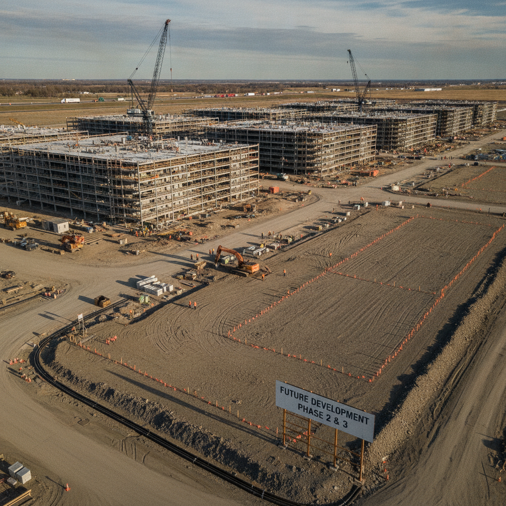
From Gross Parcel to Net Developable Area
The fundamental concept in site evaluation is distinguishing between what you own and what you can actually build on. Gross acreage is the total area within the property boundaries as defined by a survey. Net developable acreage, in contrast, is the remaining land after subtracting all constrained and undevelopable areas. These deductions include regulatory no-build zones, land required for infrastructure, and areas with physical limitations. The initial due diligence phase is where this analysis is most critical. A feasibility study should include a preliminary site plan design that maps out these constraints. Permitting requirements for land development vary by jurisdiction, and every project team should confirm the applicable standards with the local, state, regional, and federal authorities that hold review authority over the site. This early investigation prevents developers from investing heavily in a property that cannot support their ultimate build-out goals, ensuring the site can accommodate not just Phase 1 but all future expansion pads.
Identifying Environmental and Regulatory Constraints
Data Center Site Acreage Deduction Analysis
| Constraint / Deduction | Typical Impact on Acreage | Key Civil Engineering Task |
|---|---|---|
| Wetlands & Buffers | Highly variable; can render 5-50%+ of a site unusable. | Wetland delineation, agency coordination, and avoidance/mitigation planning. |
| 100-Year Floodplain | Can prohibit development in affected areas entirely. | FEMA map analysis, topographic survey, and design of compensatory storage. |
| Utility & Access Easements | Sterilizes linear corridors across the property. | Title and survey review, easement mapping, and site layout optimization. |
| Stormwater Management Ponds | Typically consumes 10-15% of the developed area. | Hydrologic modeling, drainage design, and pond footprint calculation. |
| Substation & Generator Yard | Can require 2-10+ acres depending on power needs. | Utility coordination with the power provider and equipment layout planning. |
| Setbacks & Landscape Buffers | Reduces the buildable envelope along all property perimeters. | Zoning code analysis and creation of a site-specific zoning exhibit. |
| Internal Roads & Parking | Consumes significant area for circulation and access. | Traffic flow analysis, parking layout design, and ensuring ADA compliance. |
Environmental regulations are often the most significant factor in reducing developable land. Federal, state, and local rules protect sensitive natural resources, and development within or near these areas is either prohibited or requires extensive and costly permitting. A thorough environmental assessment is a non-negotiable part of any data center site development project. Key environmental constraints include: Wetlands and Surface Waters: Areas identified as jurisdictional waters under the Clean Water Act are heavily regulated. A formal wetland delineation is required to map these features. Development typically requires significant buffers, and any impacts often necessitate a complex federal and state environmental permitting process, which can include expensive mitigation. Floodplains: Land within the 100-year floodplain, as mapped by FEMA, presents significant risk and regulatory hurdles. Building critical infrastructure like data centers in these zones is highly discouraged or prohibited. Even if allowed, it may require elevating the facility above the Base Flood Elevation (BFE) and providing compensatory storage, consuming additional land and increasing construction costs. Protected Species and Habitats: A habitat assessment may be required to check for the presence of threatened or endangered species. If found, the Endangered Species Act and other regulations can impose severe restrictions on development, sometimes requiring large portions of a site to be set aside as conservation easements.
Accounting for Easements and Encumbrances
A property’s title commitment and survey will reveal legal encumbrances that can sterilize significant portions of a site. Easements grant specific rights to third parties, such as utility companies or adjacent landowners, to use a portion of the property. These areas are typically off-limits for permanent structures. Common easements that impact data center sites include massive, high-voltage transmission line easements, large-diameter pipeline easements for gas or water, and access easements for neighboring properties. A thorough review of all recorded encumbrances is essential. An experienced Civil Engineer near me can help map these constraints and design the site layout to work around them, but the land within them is effectively deducted from the net developable area. Ignoring a utility easement can lead to forced removal of improvements and legal action.
The Land Demands of On-Site Infrastructure
Data centers are infrastructure-heavy facilities, and the support systems themselves consume a tremendous amount of land. Unlike a typical warehouse or office building, the non-building components of a data center campus are extensive and must be factored into the net acreage calculation from day one. Major infrastructure footprints include: Stormwater Management Facilities: Every acre of new impervious surface—roofs, roads, parking lots—generates stormwater runoff that must be managed on-site. This typically requires large detention or retention ponds to control the rate and quality of water leaving the site, as mandated by NPDES permit regulations. The drainage design for these systems can easily consume 10-15% or more of a site’s area. Utility Substations and Equipment Yards: Data centers require immense power, necessitating on-site electrical substations. These facilities, along with switchgear, transformer yards, and backup generator farms with associated fuel storage, have a massive physical footprint and require significant safety and operational setbacks. Robust utility coordination is critical to right-size and place this equipment efficiently. Circulation, Parking, and Security: The site must accommodate wide roadways for construction and equipment delivery, extensive employee and visitor parking that meets ADA compliance standards, and secure perimeters. Fire access roads, truck aprons for loading docks, and required security setbacks from the property line all subtract from the area available for the main data hall buildings.
Zoning, Setbacks, and Land Use Buffers
Local land use and zoning codes impose another layer of spatial constraints. These regulations are designed to ensure orderly development and compatibility with surrounding properties. A key part of zoning compliance is adhering to prescribed setbacks and buffer requirements, which directly reduce the buildable envelope of a property. Building setbacks define the minimum distance a structure must be from the front, side, and rear property lines. Additionally, many zoning codes require landscaped land use buffers along property lines adjacent to different uses, such as residential areas. These buffers can be dozens or even hundreds of feet wide, further shrinking the usable core of the site. A variance can sometimes be sought, but it adds time and uncertainty to the permitting process.
Our Process: Master Planning for Scalability
At RSP Engineers, our approach to data center site evaluation is built on a foundation of rigorous due diligence and strategic master planning. We understand that the initial site selection is a long-term investment, and our goal is to ensure the property can support our client’s vision for years to come. Our process focuses on creating a clear roadmap from raw land to a fully operational, multi-phase campus. We begin with a comprehensive feasibility study that identifies all potential deductions to create a realistic net developable acreage map. This informs a conceptual master plan that strategically locates the initial phase while preserving logical, contiguous corridors for future expansion. By planning utility backbones, primary access roads, and stormwater systems with the ultimate build-out in mind, we protect the viability of future phases. This proactive phasing strategy is a core component of our site engineering services and prevents short-sighted design decisions from landlocking future growth potential.
Common Issues in Acreage Evaluation
Even with a structured process, developers can encounter pitfalls. One of the most common issues is the discovery of unrecorded easements or historic site uses that don’t appear on a title search, which can halt a project late in the design phase. Another frequent problem is underestimating the sheer size of stormwater management ponds, especially in areas with stringent water quality regulations. Misinterpreting zoning code requirements for setbacks or buffers can also lead to redesigns. Finally, unfavorable findings in a Geotechnical soil report, such as deep layers of unsuitable soils, can force costly ground improvement or dictate where heavy structures can be placed, disrupting an otherwise optimal layout. Engaging a qualified Geotechnical engineer early for a preliminary Soil Test can mitigate these subterranean surprises. Frequently Asked Questions What is a typical ratio of net to gross acreage for a data center site? There is no single typical ratio, as it is highly site-specific. However, it’s not uncommon for the net developable area to be only 60-75% of the gross acreage, and in cases with significant environmental or easement constraints, it can be much lower. A detailed site development analysis is the only way to know for sure. How early should a civil engineering firm be involved in site selection? A civil engineering firm should be engaged as early as possible, ideally during the initial property search and due diligence phase. Early involvement allows for rapid feasibility assessments of multiple sites, helping you focus resources on the most viable option and negotiate purchase agreements with a clear understanding of the property’s true potential and constraints. Can environmental constraints like wetlands be removed or developed? Impacting jurisdictional wetlands is possible but requires a rigorous and often lengthy permitting process through the U.S. Army Corps of Engineers and corresponding state agencies under the Clean Water Act. This path typically involves demonstrating that impacts were first avoided and minimized, and then providing compensatory mitigation, often by purchasing credits from a mitigation bank, which can be very expensive. What is the role of a Geotechnical soil report in this process? A Geotechnical soil report is critical for mission-critical projects. It analyzes subsurface conditions through methods like a soil boring test to determine soil bearing capacity, rock depth, and groundwater levels. This information dictates foundation design for heavy data center structures, pavement design, and the feasibility of excavating for utilities and stormwater ponds, directly impacting site layout and construction costs. How do you protect future expansion pads on a master plan? Protecting future expansion areas is a key goal of master planning. This is achieved by designing the initial phase’s infrastructure—roads, main utility trunks, and stormwater systems—to avoid crossing future building pads. We often recommend legally platting future pads as separate tracts or outparcels and establishing dedicated easements to serve them, ensuring their development path remains clear and unencumbered.
Maximize Your Mission-Critical Investment with RSP Engineers
Don’t let hidden site constraints compromise your expansion strategy. The success of a multi-phase data center campus depends on a clear-eyed assessment of the land’s true capacity. The team at RSP Engineers provides the expert due diligence, strategic master planning, and detailed site plan design needed to navigate complex regulatory environments and maximize your return on investment. We are one of the leading Civil Engineering firms specializing in mission-critical projects nationwide.
Conclusion
Ultimately, the advertised gross acreage of a potential data center site is merely the opening line of a complex story. The real narrative is written in the details of environmental constraints, easements, zoning codes, and the extensive infrastructure required. A proactive, detailed analysis to determine the net developable acreage is not just a technical exercise; it is a fundamental component of risk mitigation and strategic asset management. By partnering with an experienced civil engineering team, developers can ensure their chosen site provides a solid foundation for both immediate needs and long-term data center expansion.
FAQs
-
Evaluating Available Acreage for Data Center Expansion requires careful planning, qualified engineering, and compliance with the applicable codes and permits.
-
Getting Evaluating Available Acreage for Data Center Expansion right protects safety, supports regulatory compliance, and avoids costly redesigns or delays.
-
RSP Engineers provides licensed expertise and end-to-end support for Evaluating Available Acreage for Data Center Expansion, from early planning through permitting.