
Data Center Groundwater Evaluation
A technical guide for data center developers on groundwater evaluation in Florida. Learn about SHWT, dewatering, buoyancy, and permitting from RSP Engineers.
The Critical Role of Groundwater in Data Center Site Viability
Unlike typical commercial buildings, data centers feature heavy, vibration-sensitive equipment, extensive underground utility networks, and often require deep excavations for foundations and infrastructure. The presence of groundwater near the surface complicates every aspect of site development. High groundwater levels can compromise soil bearing capacity, leading to the need for expensive deep foundations or soil improvement techniques. It creates significant challenges for the installation of critical underground infrastructure, such as electrical duct banks, cooling pipes, and fuel lines, increasing the risk of water infiltration and long-term degradation. Furthermore, the financial stakes are enormous. An inadequate understanding of subsurface hydrology can lead to catastrophic budget overruns during construction, particularly if extensive construction dewatering is required. It can also trigger significant permitting delays with water management districts. For these reasons, a thorough geotechnical investigation that specifically characterizes groundwater behavior is an essential component of due diligence for any potential data center site in Florida.
Characterizing Groundwater: Static vs. Seasonal High Water Table
Groundwater Mitigation Strategies and Design Considerations
| Groundwater Challenge | Primary Design Solution | Key Permitting & Compliance Factor |
|---|---|---|
| High SHWT Impacting Foundations | Shallow foundations on improved subgrade, over-excavation and replacement with structural fill, or deep foundations (piles). | Requires detailed geotechnical report and foundation plan review by the local building department. |
| Buoyancy on Underground Tanks/Vaults | Incorporate mass concrete, anti-flotation collars, or helical/rock anchors to counteract uplift forces. | Structural calculations demonstrating positive resistance to buoyancy must be submitted for building permit approval. |
| Excavation Instability | Use of trench boxes, sheet piling, or laid-back slopes for excavation safety. | Compliance with OSHA excavation standards is mandatory. Shoring design may require a separate engineering review. |
| Perched Water Lenses | Installation of underdrains or French drains to intercept and redirect localized water. | Design must be integrated with the overall stormwater management plan and shown on civil drawings. |
| Dewatering Discharge | On-site settling basins, dewatering filter bags, or connection to a sanitary sewer (with approval). | Requires a dewatering permit from the Water Management District and adherence to NPDES turbidity limits. |
| Utility Trench Infiltration | Use of well-draining backfill material (e.g., clean sand or stone) and/or underdrains around critical duct banks. | Material specifications and trench details must be included in the construction documents for agency review. |
A key distinction in any groundwater evaluation is between the static water level and the seasonal high water table. The static water level is a snapshot in time—the depth to groundwater on the day it is measured. While useful, it can be misleading, especially during Florida’s dry season. The critical design parameter for nearly all aspects of civil engineering design is the Seasonal High Water Table (SHWT). The SHWT represents the highest level the groundwater is expected to reach during the wettest time of the year, and it governs the design of foundations, pavement sections, and, most importantly, stormwater management systems. Determining the SHWT involves more than just direct measurement. Geotechnical professionals and engineers analyze soil borings for hydrologic indicators, such as soil mottling (patches of different colors), which indicate historical water fluctuation. This data, collected from multiple locations across a site using tools like piezometers and monitoring wells, is used to create a comprehensive model of the site’s hydrology. This model is fundamental to all subsequent site plan design and engineering decisions.
Investigating Subsurface Hydrology: Piezometers and Monitoring Wells
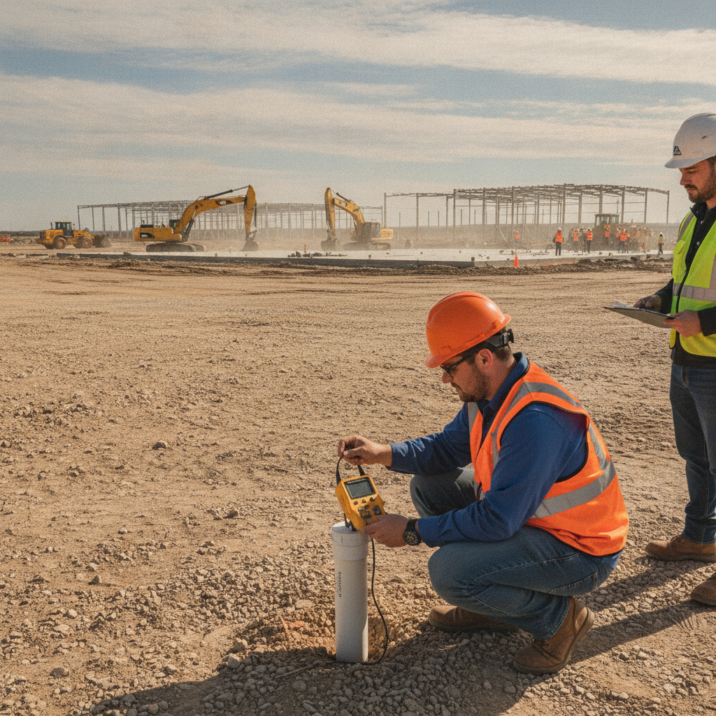
Accurately determining groundwater elevations requires a systematic approach using specialized equipment. A geotechnical investigation for a data center will typically involve the installation of both piezometers and monitoring wells. Piezometers are small-diameter pipes installed in boreholes to measure the piezometric head (water pressure) at a specific point, providing relatively quick readings of the water table elevation. They are excellent for establishing initial conditions across a large site. For long-term analysis, monitoring wells are installed. These are more robust, permanent installations that allow for repeated measurements over weeks or months. This long-term data is invaluable for capturing seasonal fluctuations and confirming the SHWT, providing the defensible data required for permit submittals to agencies like the Florida Water Management Districts. A well-planned monitoring program is the foundation of a resilient design that anticipates the true range of subsurface conditions, protecting the long-term integrity of the facility.
Impacts on Excavation and Underground Stormwater Storage
High groundwater has a profound and immediate impact on construction activities, particularly excavation. Digging below the water table causes soil to become unstable, leading to sloughing or collapse of trench walls, which poses a major safety hazard. This necessitates costly shoring systems or requires flattening the excavation’s side slopes, consuming valuable space on the project site. The most significant impact is often on the installation of underground stormwater storage systems. Modern site designs frequently use large concrete vaults or modular plastic chambers to meet stormwater management regulations without consuming surface area. Installing these systems in areas with a high water table requires extensive construction dewatering—continuously pumping water out of the excavation. This process is slow, expensive, and introduces logistical complexities related to water discharge and treatment. It can dramatically extend the construction schedule and increase costs, turning what seems like a straightforward installation into a major project challenge. Proper utility coordination and design must account for these conditions from day one.
Buoyancy and Uplift Forces on Subsurface Structures
A critical engineering principle that must be addressed is buoyancy. Just as a boat floats in water, any buried, watertight structure will be subjected to hydrostatic pressure from the surrounding groundwater, creating a powerful upward force. This uplift force can be strong enough to lift massive concrete vaults, fuel tanks, or utility manholes right out of the ground if not properly counteracted. This is a catastrophic failure that can compromise the entire facility’s infrastructure. The civil engineering design must include specific countermeasures to resist buoyancy. Common solutions include designing thick, heavy concrete base slabs, incorporating concrete anti-flotation collars, or using deep foundation elements like helical anchors or piles to hold the structure down. These uplift calculations are a mandatory part of the structural design review and are directly informed by the SHWT established during the geotechnical investigation. Ignoring buoyancy is not an option for any mission-critical project.
The Complexities of Construction Dewatering and Permitting
When excavation below the water table is unavoidable, construction dewatering becomes necessary. This process involves more than simply turning on a pump. In Florida, the withdrawal and discharge of groundwater are regulated activities. Depending on the volume of water being pumped and the duration of the operation, a Water Use Permit (WUP) or a specific dewatering permit from the governing Water Management District (e.g., SFWMD, SWFWMD) may be required. The application process for these permits can be lengthy and requires detailed engineering plans and calculations. Furthermore, the discharged water must be managed responsibly. It is often laden with sediment and must be treated—typically in a settling basin or with filtration devices—to prevent turbidity and pollution of downstream water bodies or storm sewer systems. This falls under NPDES compliance regulations. The entire dewatering operation, from permitting to discharge management, requires careful planning and can be a critical path item on the construction schedule.
RSP Engineers’ Approach to Groundwater Evaluation
At RSP Engineers, we treat groundwater evaluation as a foundational phase of our site engineering services. Our process is systematic and risk-focused. We begin with a thorough desktop due diligence study, reviewing USDA soil surveys, historical aerials, and local agency data to identify potential red flags. This informs a site-specific geotechnical investigation plan, which we coordinate with trusted geotechnical partners. We specify the number and depth of soil borings and the strategic placement of piezometers and monitoring wells to capture a complete picture of the site’s hydrogeology. Once data is collected, our engineers analyze it to establish the design SHWT and assess its implications for every aspect of the project. This information is integrated directly into the site plan design, informing decisions on building pad elevation, foundation type, utility routing, and the selection of appropriate stormwater management systems. This proactive, data-driven approach minimizes surprises during permitting and construction, saving our clients time and money while reducing project risk.
Common Pitfalls in Groundwater Assessment
Several common mistakes can undermine a data center project. The most frequent is relying on insufficient data, such as a single set of water level readings taken during the dry season. This can lead to a design based on an unrealistically low water table, resulting in major change orders during construction. Another pitfall is failing to identify and account for perched water tables—localized pockets of groundwater that sit above the main water table and can cause significant, unexpected excavation problems. Finally, underestimating the timeline and complexity of dewatering permit acquisition is a frequent source of project delays. Developers and contractors may assume pumping is a simple field activity, only to find out it requires a multi-month agency review process. A proper assessment anticipates these challenges, allowing the permitting strategy and construction schedule to be planned accordingly, avoiding costly stand-by time for crews and equipment. Frequently Asked Questions What is the difference between a piezometer and a monitoring well? A piezometer is typically a small-diameter, temporary well used to get a quick reading of the water pressure or elevation at a specific depth. A monitoring well is a more permanent, larger-diameter installation, often with a screened interval, designed for long-term data collection and water quality sampling. For a data center site development project, both may be used to build a comprehensive understanding of groundwater behavior. How long do you need to monitor groundwater levels for a data center project? The monitoring duration depends on the site’s complexity and the requirements of the reviewing agencies. While initial readings provide a baseline, monitoring through at least one significant rainy season is ideal to accurately confirm the Seasonal High Water Table (SHWT). For critical projects, a multi-month monitoring period is a prudent investment to ensure a resilient design. Can a high water table kill a data center project? It can make a project financially unfeasible. While engineering solutions exist for almost any groundwater condition, they come at a cost. Extremely high groundwater may require a complete switch to deep foundations, the importation of massive amounts of fill to raise the site grade, and perpetual dewatering. These costs can be so substantial that they render a site non-viable, making early geotechnical investigation absolutely critical. What is a ‘perched’ water table and why is it a problem? A perched water table is a localized zone of groundwater that sits above the main regional water table, trapped by an underlying layer of impermeable material like clay. It’s a problem because initial soil borings might miss it, leading crews to believe they are excavating ‘in the dry’ until they unexpectedly hit this saturated zone, causing excavation instability and requiring unplanned construction dewatering. Who is responsible for securing a construction dewatering permit? Typically, the general contractor is responsible for obtaining the dewatering permit as it relates to their means and methods of construction. However, the design engineer provides the necessary supporting calculations and site information for the permit application. At RSP Engineers, we proactively assist the project team by identifying the need for the permit early and providing the required engineering data to streamline the permit submittal process.
De-Risk Your Mission-Critical Project with Expert Site Engineering
Don’t let subsurface surprises derail your next mission-critical project. A proactive and thorough groundwater evaluation is the key to a predictable and successful development. The team at RSP Engineers provides comprehensive site development services, from initial due diligence and geotechnical investigation coordination to integrated stormwater management design and navigating complex permitting. We help you understand the ground beneath your feet so you can build with confidence.
Conclusion
In the high-stakes world of data center development, what you can’t see can hurt you. Groundwater is a powerful, dynamic force that must be respected and planned for. A comprehensive evaluation that accurately identifies the Seasonal High Water Table and informs all aspects of design is not an expense—it is an investment in risk mitigation. By integrating a robust geotechnical analysis with expert civil engineering design, developers can avoid costly construction issues, ensure long-term structural integrity, and deliver a resilient facility ready to meet the demands of the digital age.
FAQs
-
Data Center Groundwater Evaluation requires careful planning, qualified engineering, and compliance with the applicable codes and permits.
-
Getting Data Center Groundwater Evaluation right protects safety, supports regulatory compliance, and avoids costly redesigns or delays.
-
RSP Engineers provides licensed expertise and end-to-end support for Data Center Groundwater Evaluation, from early planning through permitting.