
Data Center Site Readiness Assessment Checklist
Our civil engineering checklist for data center site readiness covers zoning, utilities, permitting, and geotechnical analysis. Ensure your mission-critical project is truly ‘shovel-ready’ with our ex
Zoning and Entitlement Verification: The Foundational Hurdle
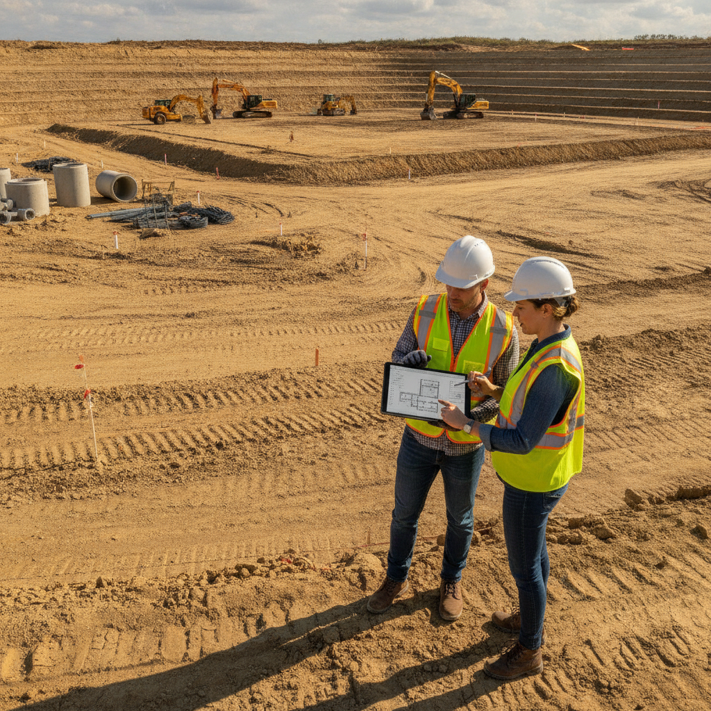
The first and most critical step is confirming the site’s legal suitability for a data center. This involves a deep dive into local land use regulations to ensure that a mission-critical facility is a permitted use. Simply being zoned for industrial or commercial use is often not specific enough. A thorough analysis includes reviewing the comprehensive plan, specific zoning district regulations, overlay districts, and any development agreements or covenants that may impact the property. Key elements to verify include allowable building height, floor area ratio (FAR), setback requirements, and noise ordinances that could affect generator operations. A site may require a conditional use permit, special exception, or even a full rezoning, each of which introduces significant time and uncertainty into the project schedule. The zoning compliance process involves formal applications, public hearings, and political approvals that can be unpredictable. Permitting requirements vary by jurisdiction, and every project team should confirm the applicable standards with the local, state, regional, and federal authorities that hold review authority over the site. Verifying entitlements is the non-negotiable foundation of any credible site development plan.
Utility Capacity and Interconnection Agreements
Data Center Site Readiness Levels
| Readiness Level | Key Characteristics | Associated Risks | Typical Timeline to Construction |
|---|---|---|---|
| Zoned Land | Property has a future land use and zoning designation that appears to allow data center use. No formal entitlements or utility commitments. | Very High: Zoning interpretation risk, unknown utility capacity, potential for major environmental or geotechnical flaws. | 18-36+ months |
| Entitled Site | Zoning and land use approvals (e.g., Conditional Use Permit) are secured. Preliminary utility discussions have occurred. | Moderate: Utility delivery timeline and cost risk, unforeseen site conditions during detailed design, permitting hurdles. | 12-24 months |
| Permit-Ready Site | Entitlements are secured. Formal utility commitment letters are executed. Substantial design and engineering are complete, and key permit applications (e.g., site plan, environmental) are submitted or approved. | Low: Risk of extensive agency review comments, minor design modifications, contractor procurement delays. | 6-12 months |
| True Shovel-Ready Site | All major land use, site development, and building permits are issued. Utility agreements are fully executed. Site is cleared and mass graded. | Very Low: Primarily limited to construction execution risk, supply chain issues, and unforeseen subsurface conditions not found in the Geotechnical soil report. | 0-3 months |
Data centers have an insatiable appetite for power, water, and fiber. A site’s viability hinges on the availability of robust, redundant, and scalable utilities. A readiness assessment must go far beyond a simple dot on a utility map. For power, this means obtaining a formal power availability study from the utility provider that confirms capacity, identifies the substation source, details necessary on-site and off-site upgrades, and provides a timeline for delivery. The potential for dual, redundant feeds from separate substations is a critical factor for uptime and a core component of utility coordination. Similarly, water for cooling systems and sewer for sanitary discharge must be confirmed through capacity letters from the local utility. This includes verifying pipe sizes, system pressures, and any required impact fees or system buy-in costs. Fiber connectivity is equally crucial, requiring an audit of nearby long-haul and local fiber providers to ensure diverse, low-latency routes are available. A site is not ready until formal commitment letters and interconnection agreements are in place, as these documents are essential for securing financing and final permitting.
Comprehensive Survey and Geotechnical Investigations
Accurate site data is the bedrock of effective design. A recent ALTA/NSPS Land Title Survey is essential for identifying property boundaries, easements, rights-of-way, and other legal encumbrances that constrain the developable area. This is supplemented by a detailed topographic survey that captures existing elevations, contours, and physical features, forming the basis for all subsequent drainage design and grading plans. Relying on outdated or incomplete survey data is a common and costly mistake. Below the surface, a thorough Geotechnical Engineering investigation is required to understand soil properties and subsurface conditions. A preliminary report may be sufficient for initial due diligence, but a comprehensive Geotechnical soil report based on an extensive Soil boring test program is necessary for foundation design and site grading specifications. This investigation identifies bearing capacity, potential for settlement, rock presence, and groundwater levels—all of which have major implications for construction costs and methods. A Geotechnical engineer provides critical data for the entire civil engineering team.
Environmental Permitting and Ecological Constraints
Environmental regulations can present significant and often unforeseen obstacles to development. A Phase I Environmental Site Assessment (ESA) is the standard first step to identify potential contamination from historical land uses. If recognized environmental conditions are found, a Phase II ESA involving soil and water sampling may be required. Beyond contamination, a site assessment must evaluate ecological constraints. This includes delineating jurisdictional wetlands and other surface waters, which may require permits under Section 404 of the federal Clean Water Act. An ecological assessment should also screen for the presence of threatened or endangered species and their habitats, which could trigger consultations with federal and state wildlife agencies. Furthermore, a review for cultural or archaeological resources is often required, especially on large, undeveloped tracts. Clearing these environmental hurdles is a prerequisite for obtaining a federal NPDES permit for construction stormwater discharges and satisfying local land development regulations.
Stormwater Management and Drainage Design Strategy
Data center sites, with their massive building footprints and extensive paved areas, create vast amounts of impervious surface. This dramatically increases the volume and rate of stormwater runoff, which must be managed to prevent downstream flooding and erosion. An effective stormwater management strategy is a critical component of the site plan approval process. The design must address both water quantity (peak flow control) and water quality (pollutant removal) in accordance with local, state, and federal regulations. The readiness assessment should include a conceptual drainage design that identifies a viable location and footprint for stormwater facilities, such as detention or retention ponds. This analysis confirms that the site has enough usable land to accommodate both the data center program and the required stormwater infrastructure. The design must also consider the legal point of discharge and ensure that downstream systems have adequate capacity, a key aspect of the agency review process.
Access, Roadway Improvements, and Traffic Impact
Safe and efficient access is fundamental to site viability, both during construction and for long-term operations. The site assessment must evaluate the condition and capacity of the existing road network. This includes analyzing intersection sight distance, roadway classification, and weight limits that could restrict construction vehicle access. Often, a data center project will trigger the need for off-site roadway engineering and improvements, such as the addition of turn lanes, deceleration lanes, or new traffic signals. Most jurisdictions will require a formal Traffic Impact Analysis (TIA) to quantify the project’s effect on the surrounding transportation network. This study forms the basis for negotiating required improvements with the local transportation authority. The permitting process for these improvements can be lengthy and must be factored into the overall project schedule. Early utility coordination is also vital to ensure that roadway work does not conflict with existing or proposed underground utilities.
Table: Data Center Site Readiness Levels
Readiness Level Key Characteristics Associated Risks Typical Timeline to Construction Zoned Land Property has a future land use and zoning designation that appears to allow data center use. No formal entitlements or utility commitments. Very High: Zoning interpretation risk, unknown utility capacity, potential for major environmental or geotechnical flaws. 18-36+ months Entitled Site Zoning and land use approvals (e.g., Conditional Use Permit) are secured. Preliminary utility discussions have occurred. Moderate: Utility delivery timeline and cost risk, unforeseen site conditions during detailed design, permitting hurdles. 12-24 months Permit-Ready Site Entitlements are secured. Formal utility commitment letters are executed. Substantial design and engineering are complete, and key permit applications (e.g., site plan, environmental) are submitted or approved. Low: Risk of extensive agency review comments, minor design modifications, contractor procurement delays. 6-12 months True Shovel-Ready Site All major land use, site development, and building permits are issued. Utility agreements are fully executed. Site is cleared and mass graded. Very Low: Primarily limited to construction execution risk, supply chain issues, and unforeseen subsurface conditions not found in the Geotechnical soil report. 0-3 months
How RSP Engineers Verifies Site Readiness
At RSP Engineers, our approach to data center due diligence is systematic and thorough. We begin with a comprehensive desktop analysis, leveraging GIS data, zoning codes, and utility maps to perform an initial screening. This is followed by in-depth coordination with jurisdictional staff and utility providers to verify regulations and capacity. Our team manages the procurement of critical third-party reports, including the ALTA survey, Geotechnical soil report, and Phase I ESA. We synthesize this information into a detailed due diligence report that includes a risk matrix, conceptual site layout, and a preliminary opinion of probable costs for site infrastructure. This provides our clients with a clear, data-driven understanding of a site’s opportunities and constraints. Our goal is to transform uncertainty into a clear action plan, enabling confident investment decisions and establishing a solid foundation for the subsequent site plan design and permitting phases.
Common Pitfalls in Data Center Site Assessments
Even experienced development teams can encounter pitfalls when evaluating sites for mission-critical use. One of the most common errors is underestimating the lead time for high-voltage power delivery; substation upgrades and new transmission lines can take years, not months. Another frequent issue is relying on verbal assurances from utility or planning staff, which are not binding. Formal, written commitments are mandatory. Other pitfalls include failing to identify restrictive easements or covenants early in the process, overlooking the need for off-site roadway or drainage improvements, and not budgeting for significant permit and impact fees. A final common mistake is performing an inadequate geotechnical investigation, which can lead to costly surprises like unsuitable soils or shallow rock once construction begins. A proactive, detail-oriented civil engineering approach is the best defense against these risks. Frequently Asked Questions What is the difference between “permit-ready” and “shovel-ready”? A “permit-ready” site typically has its zoning and entitlements secured and major permit applications submitted or even approved, but the final building permits may not be in hand. A true “shovel-ready” site has all discretionary and ministerial permits issued, including the building permit, allowing construction to begin immediately. The latter represents a significantly more de-risked and valuable asset. How early should a geotechnical investigation be performed? A preliminary geotechnical investigation should be part of the initial due diligence phase, before a purchase agreement is finalized. This helps identify any major red flags. A comprehensive Geotechnical soil report, with a full program of soil borings, is then required during the detailed site plan design phase to inform foundation engineering, pavement design, and earthwork specifications. Why are utility commitment letters so critical for data center projects? Utility commitment letters are legally binding documents from providers confirming they have the capacity to serve the project’s immense power and water demands and outlining the terms, costs, and timeline for providing that service. Without these formal commitments, a project’s viability is purely speculative, making it impossible to secure financing or obtain final permitting. What is a Phase I Environmental Site Assessment (ESA) and is it always required? A Phase I ESA is a report that investigates the past and present uses of a property to identify potential environmental contamination. While not always legally mandated by local government, it is a standard requirement for nearly all commercial real estate transactions and is essential for establishing liability protection under federal law. It is a critical risk management step for any site development project. Can a site’s zoning be changed to allow for a data center? Yes, it is often possible to change a site’s zoning through a rezoning or comprehensive plan amendment process. However, this is a discretionary approval process that involves public hearings and a vote by elected officials. It can be a lengthy, costly, and uncertain undertaking with no guarantee of success. A site that is already properly zoned for land development of this type is always preferable.
Partner with RSP Engineers for Your Next Mission-Critical Project
Navigating the complexities of data center site selection and due diligence requires a partner with deep technical expertise and a comprehensive understanding of the development lifecycle. The team at RSP Engineers provides the critical civil engineering, permitting, and utility coordination services needed to verify site readiness and guide your project to success. From initial feasibility studies and site plan design to full construction documents and construction administration, we help de-risk your investment and accelerate your time to market.
Conclusion: From Checklist to Certainty in Site Development
A data center site readiness checklist is more than a procedural formality; it is a strategic tool for risk mitigation. By systematically verifying zoning, utilities, geotechnical conditions, and environmental constraints, developers can move forward with confidence. True readiness is achieved through diligent investigation and expert analysis, transforming a parcel of land into a bankable project. This rigorous civil engineering due diligence is the essential first step in building the critical infrastructure of the future, ensuring that the site development process is built on a foundation of certainty.
FAQs
-
Data Center Site Readiness Assessment Checklist requires careful planning, qualified engineering, and compliance with the applicable codes and permits.
-
Getting Data Center Site Readiness Assessment Checklist right protects safety, supports regulatory compliance, and avoids costly redesigns or delays.
-
RSP Engineers provides licensed expertise and end-to-end support for Data Center Site Readiness Assessment Checklist, from early planning through permitting.