
Data Center Sinkhole Risk Assessment
A comprehensive guide for data center developers on assessing and mitigating sinkhole risks in Florida’s karst terrain, covering geophysical surveys, geotechnical borings, and remediation.
Understanding Florida’s Karst Geology and Sinkhole Formation
Florida’s landscape is a classic example of karst topography, a terrain formed from the dissolution of soluble rocks like limestone and dolomite. Rainwater becomes slightly acidic as it absorbs carbon dioxide from the atmosphere and soil, and this acidic water slowly dissolves the limestone bedrock, creating a network of underground cavities, conduits, and voids. When the overlying soils and sediments can no longer bridge these subterranean voids, the surface collapses, forming a sinkhole. Two primary types of sinkholes are of concern. Cover-subsidence sinkholes are slow, gradual depressions that occur as sandy soils slowly filter down into voids. More dangerous for data centers are cover-collapse sinkholes, which happen suddenly and catastrophically when a cohesive clay layer bridging a large void finally fails under stress. This stress can be a natural process or, critically, it can be induced by new construction, heavy structural loads, or changes in local hydrology—all hallmarks of a new data center development. Understanding the local soil stratigraphy and the depth to limestone is the first step in assessing this risk.
Phase I: The Critical Desktop Geologic Review
Comparison of Sinkhole Investigation Techniques
| Technique | Primary Application | Key Deliverable | Limitations |
|---|---|---|---|
| Desktop Geologic Review | Initial site screening and fatal flaw analysis. | A preliminary report identifying known hazards, geologic context, and areas of concern. | Relies on existing data; cannot detect unknown or unexpressed features. |
| Ground Penetrating Radar (GPR) | Detecting near-surface anomalies (0-30 ft) like voids, buried objects, and soil disturbances. | 2D/3D maps of subsurface reflectors indicating potential anomalies. | Limited depth penetration, especially in clay-rich soils. |
| Electrical Resistivity Tomography (ERT) | Deeper investigation to map changes in soil/rock resistivity, indicating voids or loose zones. | A cross-sectional image (tomogram) of subsurface resistivity. | Can be influenced by buried utilities; requires interpretation by a specialist. |
| Microgravity Survey | Detecting subsurface mass deficits (voids, low-density zones) over a broad area. | A contour map of gravity anomalies pinpointing potential karst features. | Highly sensitive to surface vibrations and topographic changes. |
| Confirmatory Borings (SPT) | Ground-truthing geophysical anomalies and collecting physical soil samples. | A detailed boring log with soil classifications, SPT values, and water levels. A full Geotechnical soil report. | Provides data only at the specific boring location; can miss features between borings. |
Before any equipment arrives on site, a thorough desktop geologic review provides the foundational context for risk. This initial phase involves compiling and analyzing existing data to identify red flags and guide subsequent physical investigations. A qualified Geotechnical engineer will meticulously review resources such as United States Geological Survey (USGS) topographic and geologic maps, historical aerial photography to spot past surface depressions, and county soil surveys. Crucially, this review includes data from the Florida Geological Survey (FGS), which maintains databases of known sinkholes and geologic hazards. We also leverage high-resolution LiDAR data to detect subtle, anomalous surface depressions that may indicate underlying instability. This phase is a cost-effective way to screen a site, identifying areas of higher concern that will require more intensive investigation and informing the strategy for the next phases of the site engineering services.
Advanced Geophysical Surveys for Subsurface Anomaly Detection
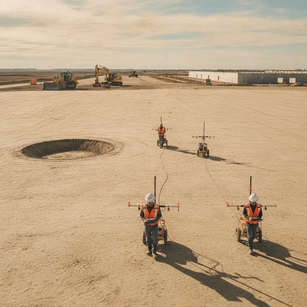
When the desktop review suggests potential risk, or for any mission-critical facility as a matter of due diligence, geophysical surveys are deployed to non-invasively map subsurface conditions. These methods measure variations in physical properties of the soil and rock to detect anomalies indicative of potential voids or loose soil zones. This approach allows for broad site coverage, efficiently identifying targets for more invasive testing. Common techniques include Ground Penetrating Radar (GPR), which sends electromagnetic waves into the ground to detect changes in soil layers and potential voids in the near-surface. For deeper investigation, Electrical Resistivity Tomography (ERT) measures how electrical current flows through the soil, identifying anomalies like air- or water-filled cavities that have different resistivity values than solid rock or compacted soil. Microgravity surveys can also be used to detect subtle changes in the earth’s gravitational field caused by subsurface voids or low-density zones, providing another layer of valuable data for the Geotechnical Engineering analysis.
Confirmatory Geotechnical Borings and Soil Analysis
Geophysical surveys are excellent for identifying anomalies, but they require physical confirmation. This is achieved through a targeted program of confirmatory borings. Unlike a standard grid-based boring program for a typical Geotechnical soil report, this investigation focuses on the specific anomalies detected during the geophysical survey. Drill rigs are mobilized to these precise locations to physically probe the subsurface conditions. During drilling, engineers perform the Standard Penetration Test (SPT) to measure soil density and strength at various depths. A sudden drop in SPT resistance or a loss of drilling fluid can indicate a void or a very loose soil zone—a classic sign of raveling. Soil samples are collected and returned to the lab for analysis to understand their composition and engineering properties. The data from these borings provides the definitive ground-truth needed to characterize the risk and design an appropriate remediation plan. This is a critical step in the site plan design process.
Differentiating Sinkhole Mechanisms: Raveling vs. Cover-Collapse
Understanding the specific mechanism of potential sinkhole formation is key to designing effective mitigation. The most common process in Florida is known as raveling. This occurs when loose, sandy overlying soils slowly migrate or ‘ravel’ downward into a solution feature in the underlying limestone, creating a progressively larger and taller chimney of loose material that eventually reaches the surface and collapses. This is often what the confirmatory borings are designed to detect. In contrast, a cover-collapse sinkhole occurs where a more cohesive, bridging layer of clay exists above the limestone void. This clay layer can support the surface for a long time, masking the danger below. However, factors like increased load from a building, vibrations from construction, or changes in groundwater levels can cause this bridging layer to fail suddenly and without warning. Identifying the presence and integrity of this cohesive soil layer is a primary objective of the geotechnical investigation.
The Impact of Site Development on Sinkhole Risk
A pristine site may be stable for centuries, but the act of development can dramatically alter the subsurface equilibrium and trigger a sinkhole. The immense weight of a data center’s foundation and equipment increases the stress on underlying soils. Vibrations from pile driving or heavy construction traffic can destabilize loose soil zones. However, one of the most significant factors is the alteration of surface water drainage. Data centers create vast, impervious surfaces (roofs, parking lots) that require robust stormwater management systems. If a stormwater retention or detention pond is sited directly over a subsurface anomaly, the concentrated infiltration of water can accelerate limestone dissolution, wash away supporting soils, and increase hydrostatic pressure, potentially triggering a collapse. Proper drainage design, informed by a thorough sinkhole risk assessment, is absolutely critical to prevent the solution from becoming the problem.
RSP Engineers’ Phased Approach to Sinkhole Risk Assessment
At RSP Engineers, we employ a systematic, phased approach to de-risk data center sites. Our process begins with a comprehensive desktop study to establish a baseline understanding. We then design and oversee a targeted geophysical survey program tailored to the site’s specific geology and the client’s risk tolerance. The results of this survey allow us to strategically locate confirmatory borings, maximizing their effectiveness while minimizing unnecessary drilling. This integrated approach ensures that we build a complete picture of the subsurface. If significant risks are confirmed, our team of Civil engineers works alongside specialist geotechnical partners to design robust remediation plans, such as compaction grouting or other ground improvement techniques. We manage the process from initial assessment through remediation design and oversight, providing our clients with the confidence that their critical infrastructure is built on solid ground.
Common Pitfalls in Data Center Site Selection
Several common oversights can lead to significant problems down the road. One major pitfall is relying solely on a standard grid-based geotechnical investigation without incorporating geophysics. This approach can easily miss isolated but critical karst features located between boring locations. Another error is failing to properly site stormwater infrastructure away from identified subsurface anomalies, inadvertently creating a future problem. Developers should also be wary of fast-tracking site selection without a thorough review of historical aerials and LiDAR data, which can reveal subtle clues about past sinkhole activity. Finally, assuming that a ‘clear’ site in a generally low-risk area is completely safe is a dangerous assumption in Florida. A site-specific assessment is always necessary for mission-critical facilities, a service provided by top Civil Engineering Firms like ours.
Secure Your Mission-Critical Investment with RSP Engineers
Protecting a data center investment in Florida requires a proactive and highly specialized approach to subsurface risk. The team at RSP Engineers provides the expert civil engineering and project management oversight necessary to navigate these complex challenges. We coordinate with leading geotechnical experts to deliver comprehensive risk assessments, from initial site development planning and permitting to the design of robust stormwater and utility systems that account for the unique geological risks. Don’t leave the stability of your mission-critical facility to chance. Contact us to ensure your project is built on a foundation of certainty.
Conclusion
For data center developers in Florida, sinkhole risk is not a remote possibility but a tangible threat that must be addressed with rigorous engineering analysis. A multi-phased approach, combining desktop reviews, advanced geophysical surveys, and targeted geotechnical borings, is the only reliable method to characterize and mitigate this risk. By investing in a thorough upfront assessment, developers can avoid catastrophic failures, ensure long-term operational resiliency, and protect their critical infrastructure. This proactive diligence is a hallmark of sound site development and responsible civil engineering, providing peace of mind for any mission-critical facility.
FAQs
-
A sinkhole risk assessment should begin as early as possible, ideally during the initial due diligence and site selection phase. A preliminary desktop review can help identify high-risk properties before a purchase is even made, saving significant time and money.
-
Often, yes. Identifying the risk is the first step to mitigating it. With proper engineering, sites with known voids or unstable soils can be remediated using techniques like compaction grouting or deep foundations to transfer loads to competent bedrock, making the site safe for development.
-
Not always. A standard report is typically focused on bearing capacity and settlement for foundation design. It may not involve the specialized geophysical surveys or boring patterns needed to specifically investigate and characterize deep karst features. A dedicated sinkhole or karst vulnerability assessment is recommended for mission-critical projects.