
Data Center Geotechnical Investigations Explained
Learn the critical steps of a geotechnical investigation for data center development in Florida, from soil borings and lab testing to foundation design recommendations. RSP Engineers explains.
The Critical Role of Geotechnical Data in Site Selection
Before a single line is drawn on a site plan design, a preliminary geotechnical assessment is a crucial step in the due diligence process for data center development. The findings can make or break a site’s viability. Identifying subsurface risks like deep layers of compressible organic soils, a shallow rock profile requiring expensive blasting, or karstic conditions common in Florida can immediately flag a property as cost-prohibitive. This early-stage investigation provides the initial data needed for high-level cost modeling and risk assessment. Our role as a civil engineering firm near me often begins here, helping developers and investors understand the financial implications of the ground beneath their feet. A site that looks perfect on paper can hide significant challenges that only a targeted Geotechnical Engineering program can reveal. This proactive approach prevents costly surprises during the permitting and construction phases, ensuring the project’s financial model remains sound. The goal is to confirm that the site can support the immense structural loads and infrastructure without requiring extraordinary and budget-breaking ground improvement techniques.
Phasing the Investigation: Due Diligence vs. Design-Level Scopes
Comparison of Geotechnical Investigation Phases for Data Centers
| Aspect | Due Diligence Phase | Design-Level Phase |
|---|---|---|
| Primary Goal | Identify fatal flaws, assess general site feasibility, and inform preliminary cost models. | Provide specific engineering parameters for final foundation, pavement, and earthwork design. |
| Boring Depth & Spacing | Wider spacing (e.g., 200-300 ft grid), shallower depths (e.g., 20-40 ft) to establish general stratigraphy. | Tight spacing focused on building/equipment footprints (e.g., 50-100 ft), deeper borings (e.g., 80-100+ ft) under heavy loads. |
| Field Testing | Primarily Standard Penetration Tests (SPT) to get a baseline of soil density and consistency. | Extensive SPTs, potential for Cone Penetration Tests (CPT), and installation of piezometers for groundwater monitoring. |
| Laboratory Testing | Limited program focused on soil classification, moisture content, and identifying problematic soils (e.g., organics). | Comprehensive suite including consolidation, shear strength, and corrosivity tests on representative samples. |
| Key Deliverable | A preliminary letter or report outlining findings, major risks, and general recommendations. | A detailed Geotechnical soil report with specific design values for bearing capacity, settlement, and pavement sections. |
| Impact on Project | Go/No-Go decision on site acquisition. High-level budget allocation for site work and foundations. | Drives final structural and civil engineering design, forms basis for construction specifications and quality control. |
A data center geotechnical investigation is not a one-size-fits-all activity; it’s a phased process that aligns with the project lifecycle. The initial phase, conducted during due diligence, involves a broader, less intensive exploration. The goal is to identify major flaws and characterize the site generally. This may involve a wider spacing of soil boring test locations to develop a preliminary understanding of soil stratigraphy and groundwater levels. Once a site is selected and moves into the design phase, a much more detailed investigation is required. This design-level program focuses on the specific footprints of the main data hall, administrative buildings, and critically, the exterior equipment yards that house heavy generators and cooling units. The density and depth of borings increase significantly to provide the granular data needed for precise foundation design, settlement analysis, and earthwork specifications. This phase provides the core engineering parameters that the structural engineer and Civil Engineer near me will use for the final design.
Tailoring the Field Exploration Program for Data Center Loads
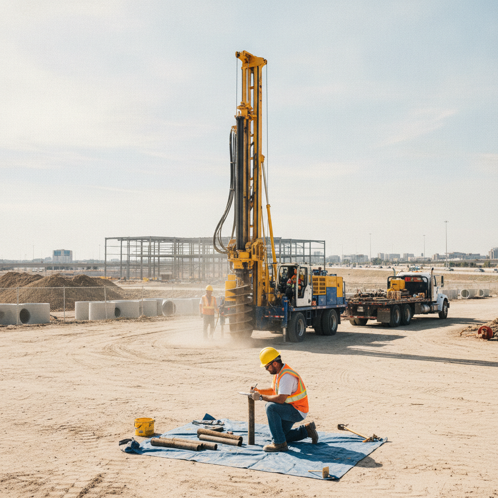
The field exploration for a data center must be meticulously planned to account for its unique loading conditions. Data halls often feature slab-on-grade foundations designed for live loads exceeding 300 pounds per square foot (psf), far greater than typical commercial buildings. The investigation must gather data deep enough to analyze both immediate and long-term settlement under these heavy, sustained loads. This often means extending the soil boring test to depths of 80-100 feet or more below the proposed foundation level. Field testing methods like the Standard Penetration Test (SPT) are performed at regular intervals within each boring to measure the soil’s relative density and consistency. For sites with soft clays or silts, Cone Penetration Testing (CPT) may be used to provide a continuous profile of soil behavior. The layout of these tests is strategic, with borings concentrated at building corners, interior column locations, and beneath the massive concrete pads planned for backup generators and cooling infrastructure. This targeted approach ensures that the most critical areas receive the highest level of scrutiny, mitigating risks associated with differential settlement.
Laboratory Testing: Uncovering Critical Soil Properties
Soil samples collected during the field exploration are transported to a certified laboratory for a comprehensive testing program. This is where the raw field data is translated into the specific engineering properties needed for design. The testing suite is tailored to the soil types encountered and the project’s specific requirements. Key laboratory tests for a data center project include: Moisture Content and Atterberg Limits: To classify fine-grained soils (clays and silts) and assess their plasticity and behavior when wet. Sieve Analysis and Hydrometer: To determine the grain size distribution of coarse-grained soils (sands and gravels). Consolidation Tests: To measure the compressibility of clay soils under load, which is critical for predicting long-term foundation settlement. Unconfined Compression or Triaxial Shear Tests: To determine the shear strength of the soil, a key parameter for foundation bearing capacity and slope stability analysis. Corrosivity Series (pH, resistivity, sulfates, chlorides): To assess the potential for soil to corrode buried concrete and steel elements, informing material selection for foundations and underground utilities.
Groundwater’s Impact on Design and Construction
Understanding the groundwater conditions at a data center site is paramount. The investigation must accurately determine the seasonal high groundwater table, as its presence has profound implications for several aspects of the site development. A high water table can exert significant hydrostatic pressure on foundations and any below-grade structures, potentially requiring robust waterproofing and permanent sub-drains. It also dictates the feasibility and cost of excavation and dewatering efforts during construction. Furthermore, groundwater levels directly influence the drainage design and stormwater management strategy. In many parts of Florida, stormwater systems rely on exfiltration trenches or dry retention ponds to percolate water back into the ground. If the water table is too high, these systems will not function correctly, necessitating more complex and expensive solutions like wet detention ponds or underground vaults. This is a critical piece of information needed for securing environmental and stormwater permits from agencies like the Water Management Districts.
The Geotechnical Report: Translating Data into Actionable Recommendations
The culmination of the field and laboratory work is the formal Geotechnical soil report. This document is the cornerstone for the site’s structural and civil design. It moves beyond raw data to provide clear, actionable recommendations. A Professional Engineer specializing in geotechnical engineering authors the report, which provides site-specific guidance on foundation systems (e.g., shallow spread footings vs. deep foundations like piles), allowable soil bearing pressures, and estimated settlement magnitudes. The report also includes critical parameters for the civil engineering team, such as pavement design recommendations for access roads and parking lots capable of handling heavy truck traffic. It will specify earthwork procedures, including requirements for subgrade preparation, fill material specifications, and compaction criteria. Finally, it provides the seismic site classification as required by the Florida Building Code, which is essential for the structural engineer’s lateral design of the building.
RSP’s Integrated Approach to Geotechnical and Site Civil Engineering
At RSP Engineers, we view the geotechnical investigation not as a standalone report, but as the foundational dataset for the entire site development process. Our team of Civil Engineers works in close collaboration with our geotechnical partners from day one. This integration ensures that the geotechnical findings are not just acknowledged but are woven into the fabric of the site plan design, drainage design, and utility coordination efforts. This collaborative approach allows for real-time value engineering. For example, if the geotechnical report indicates moderately compressible soils, we can immediately assess the cost-benefit of slight building repositioning versus implementing more costly ground improvement techniques. Our expertise in providing comprehensive site engineering services ensures that recommendations from the Geotechnical engineer are practically and efficiently implemented in the overall construction documents, streamlining the path to permitting and construction.
Common Geotechnical Issues for Florida Data Center Sites
Developing data centers in Florida presents a unique set of geotechnical challenges that demand local expertise. The state’s geology requires a keen eye for potential risks that can derail a project if not properly identified and mitigated. One of the most significant concerns is karst terrain, prevalent in much of Central and North Florida, which carries the risk of sinkholes. Specialized geophysical surveys and a carefully planned boring program are essential to assess this risk. Other common issues include thick strata of loose, sandy soils that may require densification to support heavy foundation loads, and the presence of organic soils or buried debris in near-surface layers, which are unsuitable for structural support and must be removed and replaced. The pervasively high groundwater table across the state complicates nearly every aspect of earthwork and foundation construction. As one of the leading Civil Engineering firms in the region, we have extensive experience navigating these challenges in compliance with the stringent requirements of the Florida Building Code. Frequently Asked Questions (FAQ) How deep do soil borings need to be for a data center? The depth is determined by the anticipated stress influence of the foundation. For heavily loaded data center structures, borings often extend 80 to 100 feet or deeper to ensure that deep, compressible soil layers are identified. The goal is to investigate the soil to a depth where the building’s load no longer has a significant effect on foundation settlement. What happens if you find poor soil during due diligence? Discovering poor soil conditions early is actually a positive outcome of due diligence. It allows the development team to make an informed decision. Options may include abandoning the site for a more suitable one, negotiating the land price to offset remediation costs, or incorporating ground improvement techniques (like deep dynamic compaction or stone columns) into the project budget and schedule from the outset. Can the geotechnical report affect my stormwater permit? Absolutely. The geotechnical investigation determines soil permeability and the depth to the seasonal high groundwater table. This data is essential for the drainage design and is a required component of stormwater management permit applications. If the soil doesn’t percolate well or the water table is too high, it directly impacts the type and size of the required stormwater system. How does a Geotechnical engineer coordinate with the structural engineer? The coordination is constant and critical. The Geotechnical engineer provides the structural engineer with the foundational design parameters: allowable soil bearing capacity, estimated total and differential settlement, and seismic site class. The structural engineer uses this data to design the building’s foundations, ensuring they can safely transfer the building loads to the ground without excessive movement. Is a single Soil Test enough for a large campus? No, a single Soil Test or boring is never sufficient for a data center campus. A comprehensive field exploration program with multiple, strategically located borings is necessary to understand the variability of subsurface conditions across the entire site. A large campus requires a robust investigation to account for potential changes in soil type, density, and groundwater levels from one end of the property to the other.
Partner with RSP for Your Mission-Critical Development
A successful data center project rests on a foundation of precise data and expert interpretation. Navigating the complexities of a thorough geotechnical investigation and integrating its findings into a cohesive site design requires a partner with proven experience. RSP Engineers provides the expert site engineering services needed to de-risk your project. Our team of Florida Licensed Engineers excels at managing everything from the initial Geotechnical Engineering assessment to final permitting and Construction Management Services. Contact us to discuss how we can support your next mission-critical facility in Florida.
Conclusion
The geotechnical investigation is an indispensable investment in the long-term viability and reliability of a data center. It is the first and most critical step in mitigating subsurface risk, controlling construction costs, and ensuring the structural integrity of a multi-million dollar asset. By moving beyond a basic assessment to a phased, data-center-specific program, developers can build with confidence. Integrating these crucial geotechnical findings with an expert civil engineering design process is the definitive strategy for laying a foundation for success in the competitive mission-critical market.
FAQs
-
Data Center Geotechnical Investigations Explained requires careful planning, qualified engineering, and compliance with the applicable codes and permits.
-
Getting Data Center Geotechnical Investigations Explained right protects safety, supports regulatory compliance, and avoids costly redesigns or delays.
-
RSP Engineers provides licensed expertise and end-to-end support for Data Center Geotechnical Investigations Explained, from early planning through permitting.