
Case Study: Design vs. As-Built Drainage Analysis for an FDOT Roadway Widening on SR 484 in Ocala, Florida
A civil engineering case study on the design vs. as-built drainage analysis for an FDOT roadway widening project in Ocala, FL, after a field change. Learn how RSP Engineers verified stormwater compliance
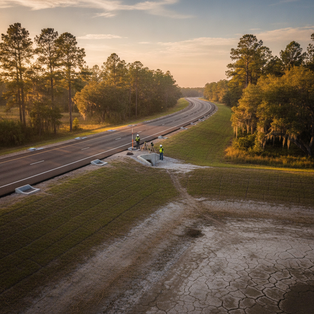
Project Overview
A roadway contractor undertaking a significant widening project along SR 484 in Ocala, Florida, required specialized civil engineering support. During construction, the team encountered unexpected soil conditions that necessitated a field change to the permitted drainage design. While the change was necessary to continue construction, it created uncertainty about the performance of the as-built stormwater management system. RSP Engineers was engaged to perform a comprehensive pre- versus post-construction drainage analysis. Our task was to take the as-built survey data, remodel the entire stormwater system, and compare its performance against the original, approved design. The goal was to provide the contractor with a definitive engineering analysis and a formal drainage report documenting that the as-built system continued to meet the stringent design criteria of the Florida Department of Transportation (FDOT) and the St. Johns River Water Management District (SJRWMD).
Site and Regulatory Context
Project at a Glance
| Category | Details |
|---|---|
| Location | SW Highway 484 (SR/CR 484), Ocala, Marion County, Florida |
| Client / Owner Type | Roadway Contractor |
| Project Type | Post-Construction Drainage Analysis for Roadway Widening |
| Scale | 48.63 total acres analyzed |
| RSP Engineers Scope | Civil Engineering, Stormwater Modeling, As-Built Analysis, Regulatory Documentation |
| Key Deliverables | Comparative Hydrologic & Hydraulic Modeling, As-Built Drainage Report |
The project is located within the FDOT right-of-way in Marion County, Florida, a region characterized by sandy soils and a distinct hydrogeology. The total analyzed area included 23.63 acres of right-of-way and an additional 25.01 acres of adjacent off-site land that drains toward the roadway, for a total basin of 48.63 acres. The site is located in FEMA Flood Zone X, indicating a minimal risk of flooding. The project’s stormwater management system was designed to meet the rigorous standards for water quality treatment and peak discharge attenuation required by both FDOT and the SJRWMD. Navigating the regulatory landscape for transportation projects requires a deep understanding of agency-specific criteria for everything from runoff calculations to construction specifications. Permitting requirements vary by jurisdiction, and every project team should confirm the applicable standards with the local, state, regional, and federal authorities that hold review authority over the site. For this project, adherence to the approved permit submittals was paramount, and any deviation, even a necessary field change, required robust engineering justification to demonstrate continued compliance.
Engineering Challenges
The primary challenge was not designing a new system, but verifying an altered one. When a field change occurs, the question is no longer theoretical; it’s about confirming the real-world performance of what was actually built. The core engineering challenge was to determine if the as-built configuration of inlets, pipes, and ponds—with different elevations than the permitted design—still provided the required water quality treatment and flood protection across a range of design storm events. This required meticulous data integration and precise hydraulic modeling. This process is critical because even minor changes in pipe inverts or structure rim elevations can have cascading effects on a drainage system’s capacity and efficiency. A lower rim might accept runoff sooner, while a higher invert could reduce pipe slope and conveyance capacity. Our analysis had to quantify these effects and provide a clear, data-driven conclusion on whether the system’s overall performance in stormwater conveyance, storage, and treatment remained compliant with the original site plan design.
RSP Engineers’ Scope of Services
To deliver a conclusive analysis for the contractor, RSP Engineers executed a targeted scope of site engineering services. Our work focused on bridging the gap between the approved plans and the final construction with defensible engineering calculations. As-Built Data Review: We processed and integrated the contractor’s field-surveyed data for the modified drainage structures into our modeling software. Hydrologic & Hydraulic Model Recreation: We built two distinct models in Storm and Sanitary Analysis (SSA) software: one representing the original permitted design and a second representing the as-built conditions. Comparative Storm Event Analysis: We ran a full suite of design storms (from the 2-year to the 100-year event) through both models to compare key performance indicators like peak flow rates, runoff volumes, and water surface elevations. Water Quality & Quantity Verification: We calculated the as-built system’s effective water quality treatment volume and total storage capacity, comparing them directly to the permitted requirements. Formal Drainage Report Preparation: We compiled all findings, model inputs and outputs, calculations, and conclusions into a comprehensive drainage report suitable for submission to the owner and regulatory agencies.
Technical Highlights
Our detailed analysis provided the quantitative proof needed to validate the as-built system. The process involved several key technical steps that demonstrated the system’s continued compliance. Why a Field Change Triggers a Drainage Re-Analysis A field change is any deviation from the permitted construction plans made on-site. In this case, encountering unexpected soil conditions forced adjustments to the placement and elevation of several drainage structures. Such changes invalidate the original hydraulic modeling that supported the permit. A re-analysis is not optional; it’s an essential step in risk management and regulatory closure, proving the final product functions as intended and preventing future liability for the contractor and owner. Rebuilding the Model from As-Built Survey The foundation of our work was the as-built survey data. We meticulously updated the model to reflect the final constructed conditions for six key drainage structures. This included rim elevations that were roughly 1.5 feet lower and several pipe invert elevations that were raised by less than a foot. While seemingly minor, these changes required a complete rebuild of the affected model components to ensure the drainage analysis accurately reflected the system’s true hydraulic behavior. Design Versus As-Built Peak Rates and Volumes The ultimate test of the system was a direct comparison of performance metrics. Our models showed that despite the elevation changes, the as-built system performed identically to the approved design in terms of peak runoff rates and volumes. For example, in the critical 100-year, 72-hour storm event, both the design and as-built models calculated a peak inflow of 0.38 cfs. This consistency across all simulated events was the key finding that confirmed zoning compliance and design intent. Water Quality Treatment in the Swale The project’s water quality treatment was provided by a large, 6-foot-deep swale with a surface area of 57,891 square feet. The system was required to treat a water quality volume of 48.63 acre-inches (4.05 acre-feet). Our analysis confirmed the as-built swale provides 60.85 acre-inches of treatment capacity, comfortably exceeding the regulatory requirement and ensuring the project met its environmental obligations. Storage and Stage Across the Design Storms The system, comprising two retention ponds and the swale, was designed to manage all runoff on-site with no offsite discharge. The total required storage volume was 249.34 acre-inches (20.78 acre-feet). Our as-built model demonstrated a total managed volume of 602.20 acre-inches (50.18 acre-feet), more than double the required amount. Furthermore, for the 100-year, 72-hour event (14.80 inches of rainfall), the maximum water stage reached 71.48 feet, well below the system’s capacity and safely contained within the project limits. Documenting Deviations for the Owner and Agencies While the overall system performance was verified, our final report also included a structure-by-structure table documenting the specific deviations between design and as-built elevations. This transparent documentation provides a clear record for the contractor and owner and serves as the official engineering justification for the field change, closing the loop with the reviewing agencies and confirming that the project’s permitting obligations were met.
Common Issues in As-Built Verification
Projects involving as-built verification often encounter several common hurdles. The most frequent is incomplete or inaccurate survey data, which can delay the analysis and require costly re-surveys. Another issue is a misunderstanding of materiality; contractors may perceive a small change in elevation as insignificant, not realizing its potential impact on the overall hydraulic grade line and system capacity. This highlights the importance of involving a Professional Engineer early when a field change is contemplated. Furthermore, discrepancies can arise between different software models used for the original design and the as-built analysis, requiring careful calibration. Finally, documenting the justification for the field change is as important as the analysis itself. A lack of clear documentation can lead to prolonged agency review cycles and potential compliance issues long after construction is complete. Proactive communication and thorough engineering reports are the best mitigation strategies.
What This Means for Similar Projects
This case study offers valuable lessons for any developer, contractor, or public agency involved in large-scale land development or infrastructure projects nationwide. First, it underscores that a field change is not just a construction issue but a potential permitting and engineering issue. Proactively planning for an as-built analysis when changes are made can save significant time and prevent regulatory headaches at project closeout. Second, it demonstrates the power of modern hydraulic modeling software to provide definitive, data-driven answers. A comparative analysis removes subjectivity and replaces it with verifiable calculations. Finally, this project serves as a model for collaboration between contractors and engineering consultants. By engaging RSP Engineers, the contractor was able to confidently address the field change, armed with a robust engineering report that validated the integrity of the final product and fulfilled their obligations to the project owner and regulatory agencies.
Partner with RSP Engineers
Navigating the complexities of construction and post-construction verification requires a partner with deep technical expertise and a practical understanding of the field. RSP Engineers provides comprehensive civil engineering services, from initial site plan design and permitting to construction-phase support and as-built analysis. Our team is adept at resolving complex stormwater management challenges and ensuring your project remains compliant from groundbreaking to final acceptance. Whether you are facing an unexpected field change, need support with utility coordination, or require expert drainage design for a new development, our team is ready to assist. We help clients manage risk, satisfy regulatory requirements, and deliver successful projects. Contact RSP Engineers today to discuss your project’s unique challenges and learn how our expertise can ensure its success.
Conclusion
In conclusion, this SR 484 case study illustrates the critical importance of post-construction as-built drainage analysis when field changes occur. By meticulously recreating the stormwater model with as-built data, RSP Engineers was able to verify that the system’s performance remained consistent with the approved drainage design, despite necessary modifications during construction. This rigorous verification process provides certainty for contractors and owners, ensures regulatory compliance, and ultimately protects the integrity and function of public infrastructure.
FAQs
-
An as-built analysis is typically triggered by any field change that deviates from the permitted civil engineering plans for the stormwater system. This includes changes to pipe sizes, materials, slopes, or invert elevations; modifications to inlet or manhole locations and elevations; or alterations to the grading, size, or configuration of ponds and swales.
-
Surveyors collect precise horizontal and vertical location data for all constructed elements of the drainage system. A Professional Engineer then inputs this data into specialized software like Storm and Sanitary Analysis (SSA) to create a digital model that is an exact representation of the finished site, forming the basis for the new hydraulic modeling.
-
Yes, it’s possible. Compliance is based on overall system performance—such as managing peak flow rates and providing required storage volume—not just on adherence to specific elevations. An as-built drainage analysis is performed to prove that even with changes, the system as a whole still meets the permitted performance criteria for stormwater management.