
Balancing Cut and Fill on Data Center Developments
Learn how expert civil engineering balances cut and fill for data center developments, optimizing earthwork, reducing costs, and accelerating schedules. A guide from RSP Engineers.
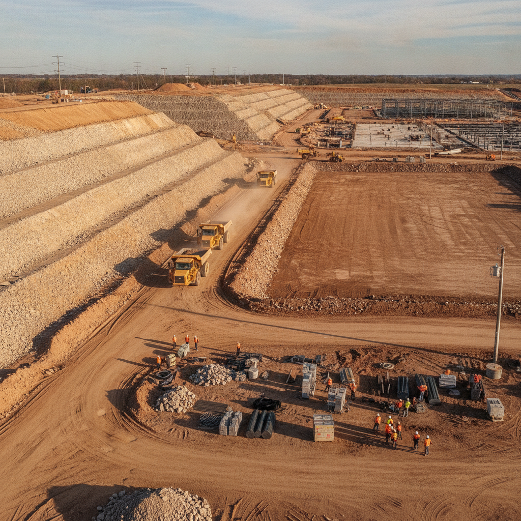
The Critical Role of Earthwork in Data Center Site Design
Data centers require vast, perfectly flat building pads to support their sprawling footprints and heavy equipment loads. Even seemingly minor variations in topography can translate into immense volumes of soil that must be moved. The process of transforming a rolling or uneven parcel into a construction-ready site is a core function of land development and civil engineering. The financial stakes are enormous; moving dirt is one of the most significant initial costs in site construction, and every cubic yard has a price tag for excavation, hauling, placement, and compaction. A well-executed mass haul analysis, which plans the most efficient movement of earth across the site, is essential. The objective is to minimize the distance and effort required to transport cut material to fill locations. Poor planning can lead to logistical bottlenecks, increased fuel consumption, and extended project timelines. Therefore, the initial site plan design must be intrinsically linked to a viable earthwork strategy, ensuring that the layout of buildings, parking, and stormwater management systems contributes to an efficient and balanced site.
Understanding Cut, Fill, and the Goal of a Balanced Site
Cut vs. Fill Material Considerations
| Factor | Cut Material Considerations | Fill Material Considerations |
|---|---|---|
| Geotechnical Properties | Is the excavated material suitable for reuse as structural fill? Rock, sand, and certain clays are often suitable. Organic soils or wet clays are typically unsuitable. | Does the fill area require material with specific properties (e.g., low permeability for a pond liner, high strength for a building pad)? |
| Compaction Requirements | Material must be placed in controlled lifts and compacted to a specified density (e.g., 95% Standard Proctor Density) to provide a stable foundation. | The type of material dictates the appropriate compaction equipment and effort needed to meet engineering specifications. |
| Handling & Placement | Rock may require blasting or heavy ripping, increasing costs. Wet soils may need to be dried before they can be used as fill. | Placement must be carefully managed to avoid creating voids or unstable zones. Moisture content must be controlled for proper compaction. |
| Cost Implications | The cost of excavation varies significantly based on material type (soil vs. rock). Unsuitable material requires costly removal and disposal. | Importing engineered fill is a major project expense. Using on-site material, even if it requires some processing, is almost always more cost-effective. |
| Regulatory Impact | Excavation may be subject to dust control, erosion control, and dewatering permits. Disturbing certain areas may trigger environmental review. | Fill placement in or near wetlands or floodplains is heavily regulated under programs like the Clean Water Act and requires specific permits. |
In the context of civil engineering, the terms ‘cut’ and ‘fill’ are straightforward. ‘Cut’ refers to the soil or rock that is excavated from areas of higher elevation on a project site. ‘Fill’ is the soil or material used to build up areas of lower elevation to a desired grade. A project achieves a ‘balanced site’ when the volume of usable cut material is sufficient to meet all the fill requirements, eliminating the need to haul material off-site (export) or bring new material in (import). Achieving this balance is the primary goal of the grading design process. Exporting excess material incurs costs for trucking and disposal, along with potential permitting hurdles. Importing fill material involves the cost of the material itself, plus transportation. Both scenarios add significant expense and complexity to a project. By strategically designing the site grades and building elevations, a skilled Professional Engineer can minimize these costs, creating a more sustainable and economically viable development plan.
The Geotechnical Investigation: Foundation of Earthwork Planning
Before any earthwork calculations can be considered reliable, a thorough geotechnical investigation is mandatory. This process, which typically involves a series of soil boring test procedures across the site, provides the essential data needed to understand subsurface conditions. The resulting Geotechnical soil report is the foundational document for all grading and foundation design. The report identifies the types of soils present, their structural properties, the depth to bedrock, and the location of the water table. Crucially, it also provides two key parameters for earthwork calculations: shrink and swell factors. The ‘swell factor’ accounts for the increase in soil volume when it is excavated from its dense, natural state. Conversely, the ‘shrink factor’ accounts for the decrease in volume as the fill material is placed and compacted. Ignoring these factors leads to inaccurate volume takeoffs and an unexpectedly unbalanced site during construction. The Geotechnical engineer plays a vital role in providing this data for the civil engineering design.
Key Factors Influencing Earthwork Balance
Achieving a perfectly balanced site is a complex puzzle with many moving parts. The initial topography is just the starting point. A civil engineer must account for numerous variables that can impact the final earthwork volumes. For instance, the top layer of soil, or topsoil, is typically stripped and stockpiled for later use in landscaping. This volume must be subtracted from the cut calculations and planned for separately. Similarly, the geotechnical investigation may identify pockets of unsuitable materials, such as organic soils or debris, which must be removed and exported, creating a deficit that needs to be filled with suitable material. Furthermore, the design itself introduces new variables. The excavation for stormwater management ponds, utility trenches, and building foundations all generate cut material. The backfill for these same trenches may have specific material requirements, affecting how on-site soil can be used. Grading and earthwork permitting requirements vary by jurisdiction, and every project team should confirm the applicable standards with the local, state, regional, and federal authorities that hold review authority over the site. These regulations can impose limits on slope steepness or require specific soil stabilization measures, directly influencing the grading design and overall earthwork balance.
Techniques for Achieving a Balanced Site
When initial calculations show an imbalanced site, the civil engineering team has several tools at its disposal to optimize the design. The most powerful technique is adjusting the proposed finished floor elevation (FFE) of the data center building pad. Lowering the FFE generates more fill material from the pad excavation and reduces the fill needed in lower areas of the site. Conversely, raising the FFE reduces the amount of cut from the pad and increases the fill demand elsewhere. This iterative process seeks the ‘sweet spot’ where cut and fill volumes converge. Other techniques include modifying the site layout to better conform to existing topography, which can reduce the overall earthwork quantity. For sites with significant grade changes, the strategic use of retaining walls can reduce the footprint of steep slopes, thereby decreasing the amount of fill material required. The design of stormwater detention ponds can also be optimized; for example, a deeper pond on a smaller footprint can be used to generate needed cut material if the site is fill-heavy. This holistic approach to site development is key to achieving balance.
Earthwork Volume Calculation and Analysis
Modern civil engineering relies on sophisticated software to perform accurate earthwork calculations. The process begins by creating a digital terrain model (DTM) of the existing site conditions, typically generated from a detailed topographic survey. The engineer then creates a second DTM representing the proposed final grades, including the building pad, parking lots, access roads, and stormwater features. By comparing these two surfaces, the software can precisely calculate the total volume of cut and the total volume of fill required. This analysis produces detailed volume calculations and visual aids like cut-fill maps, which use a color gradient to show areas of excavation and embankment across the site. These tools are invaluable for visualizing the earthwork strategy and communicating it to the project team and contractor. For complex sites, a mass haul diagram can be developed to plan the most efficient haul routes and minimize equipment travel time, further optimizing the construction process.
The RSP Engineers Approach to Earthwork Optimization
At RSP Engineers, our approach to earthwork optimization is proactive and data-driven, beginning in the earliest stages of due diligence. We start with a comprehensive site assessment, working closely with a Geotechnical engineer to understand the subsurface conditions that will drive the design. This early insight allows us to identify potential challenges, such as shallow rock or unsuitable soils, and develop a preliminary grading design that respects the site’s natural constraints. Using advanced 3D modeling software, our team performs iterative analyses, adjusting building elevations and site layouts to find the most cost-effective path to a balanced site. We collaborate closely with the developer, architect, and contractor to ensure our design aligns with the project’s operational needs and construction logistics. During construction, we provide robust construction administration services, helping the contractor interpret the design, solve unforeseen field conditions, and verify that earthwork is performed according to the project specifications and permit submittals.
Common Challenges in Balancing Cut and Fill
Even with meticulous planning, earthwork operations can encounter challenges. The most common issue is discovering unforeseen subsurface conditions that differ from what the soil boring test indicated. Hitting a large rock ledge or a deep pocket of unsuitable muck that was missed by the borings can force significant changes to the grading plan and budget. Severe weather can also cause major delays, as overly wet soil cannot be properly compacted and may need time to dry out, impacting the schedule. On large, multi-phase data center campuses, earthwork must be carefully sequenced. Stockpiling soil from one phase for use in a future phase requires careful planning and a significant amount of space. Finally, late-stage changes to the building footprint, utility alignments, or parking layouts can undo a carefully balanced site, requiring a complete re-analysis of the earthwork and potentially leading to costly import or export of material. Early design finalization is key to avoiding these issues.
Partner with RSP for Your Data Center Development
Achieving an optimized, balanced site for a mission-critical facility requires a deep understanding of geotechnical principles, grading strategies, and construction logistics. The team at RSP Engineers brings nationwide experience to every project, delivering innovative and cost-effective solutions for the most complex data center developments. We specialize in comprehensive site engineering services, from initial due diligence and zoning compliance through final permitting and construction. Let us help you minimize earthwork costs and accelerate your project schedule. Our expertise in stormwater management, utility coordination, and agency navigation ensures a smooth path from design to operation. Contact us today to discuss how our civil engineering team can support your next data center project.
Conclusion
Balancing cut and fill is more than just moving dirt; it is a strategic discipline at the heart of successful site development. For data center projects, where efficiency and cost-certainty are paramount, optimizing earthwork is a non-negotiable step. Through careful analysis, data-driven design, and a deep understanding of construction realities, a balanced site minimizes costs, reduces project risk, and sets the stage for a successful build. Proactive civil engineering and a robust grading design are the keys to transforming a challenging piece of land into a valuable, construction-ready asset.
FAQs
-
Swell is the percentage increase in volume when soil is excavated from its natural, compacted state. Shrink is the percentage decrease in volume when that same soil is re-compacted as fill. A Geotechnical soil report provides these factors, which are essential for converting ‘bank’ cubic yards (in the ground) to ‘loose’ cubic yards (in the truck) and ‘compacted’ cubic yards (in the fill), ensuring accurate earthwork quantities.
-
Costs vary significantly based on geographic location, local availability of fill material or disposal sites, and trucking distances. However, both importing and exporting material can add hundreds of thousands or even millions of dollars to a large data center project. This is why achieving a balanced site through expert civil engineering is a primary cost-saving strategy.
-
Often, yes. Rock can be an excellent fill material if it is processed correctly. This typically involves crushing the rock to a specified size so it can be placed in lifts and properly compacted. While there is a cost to crush the rock, it is almost always cheaper than exporting the rock and importing an equivalent volume of soil for structural fill.