
Wetland Delineation During Data Center Site Selection
A guide to the wetland delineation process for data center development. Learn about the three-parameter approach, jurisdictional determinations, and how wetlands impact site selection and civil engine
The Three-Parameter Approach to Wetland Identification
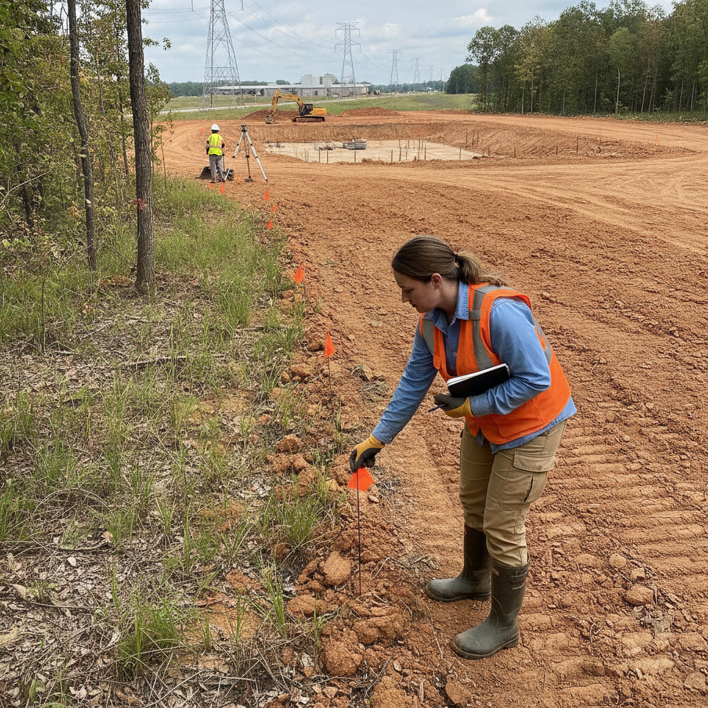
The foundation of a defensible wetland delineation is the nationally accepted three-parameter approach, established by the U.S. Army Corps of Engineers (USACE). A qualified wetland scientist must document the presence of all three characteristics to confirm an area as a wetland. This scientific methodology ensures that determinations are consistent and based on verifiable field evidence rather than casual observation. The absence of any one parameter means the area does not meet the technical criteria for a jurisdictional wetland. The three critical parameters are: Hydrophytic Vegetation: This refers to plant life that is adapted to thrive in saturated soil conditions. Delineators identify dominant plant species on a site and cross-reference them with national or regional plant lists that classify their affinity for wetland environments. The prevalence of obligate wetland plants is a strong indicator of a wetland ecosystem. Hydric Soils: These are soils that formed under conditions of saturation, flooding, or ponding long enough during the growing season to develop anaerobic (oxygen-deprived) conditions in the upper part. Field indicators include specific soil colors, mottling patterns (spots of different colors), and sometimes a sulfurous odor, all of which a Geotechnical engineer can help identify during a preliminary Soil Test. Wetland Hydrology: This parameter requires evidence that the area is inundated or saturated at a sufficient frequency and duration to support the vegetation and create the hydric soils. Primary indicators include visible surface water, high water tables observed in a soil pit, and water marks on trees. Secondary indicators might include drainage patterns and sediment deposits. A comprehensive civil engineering analysis is often needed to understand the site’s hydrology.
Desktop Analysis vs. Formal Field Delineation
Wetland Delineation Process: Key Stages and Considerations
| Stage | Key Activities | Data Center Implication |
|---|---|---|
| Desktop Screening | Review NWI maps, soil surveys, aerials, and topographic data. | Initial risk assessment to flag potential sites with high wetland probability before committing significant resources. |
| Formal Field Delineation | On-site investigation by a wetland scientist to apply the three-parameter test and place flags. | Establishes the precise, field-verified boundary of wetlands, providing the first real look at the buildable area. |
| Boundary Survey & Mapping | A licensed surveyor locates the field flags and incorporates the boundary into the project's base map. | Creates the legally defensible map required for design, permitting, and the official JD submittal. |
| Jurisdictional Determination (JD) | Submit delineation report and survey to the USACE for verification and an official determination. | Provides regulatory certainty for five years, which is critical for project financing and long-term phasing. |
| Permitting & Mitigation | If impacts are unavoidable, prepare a Section 404 permit application and develop a mitigation plan. | A complex, often lengthy process that can involve purchasing wetland credits or creating new wetlands, adding significant cost and time. |
The wetland assessment process typically begins with a desktop analysis. This preliminary screening uses publicly available resources like the National Wetlands Inventory (NWI) maps, historical aerial photography, topographic maps, and soil surveys. This step is a cost-effective way to flag potential risks and inform initial feasibility studies. However, these resources are not precise enough for site plan design and should never be considered a substitute for a formal field investigation. NWI maps, for example, are known to be inaccurate or incomplete. A formal field delineation is the definitive step. It involves a qualified wetland scientist physically walking the property to perform the three-parameter analysis. They dig soil pits, identify plant species, and look for hydrologic indicators. Once the wetland boundary is identified, it is marked with sequentially numbered flags. This flagged line represents the official limit of the wetland for permitting and design purposes. This process is essential for any serious land development project and provides the data needed for accurate site engineering services.
The Jurisdictional Determination (JD) Process
Once the wetland boundary is flagged in the field, the next step is to obtain an official confirmation from the regulatory agencies, primarily the USACE. This is accomplished through a Jurisdictional Determination (JD). A JD is a formal, legally binding document that confirms the presence and boundaries of jurisdictional Waters of the U.S., including wetlands, on a property. Obtaining an Approved JD (AJD) provides the project owner with regulatory certainty, which is critical for financing and long-term planning. An AJD is typically valid for five years. The submittal package for a JD includes a detailed report, field data sheets, and a survey map showing the flagged wetland lines. Wetland regulations and permitting requirements vary by jurisdiction, and every project team must confirm the applicable standards with the local, state, regional, and federal authorities that hold review authority over the site. Navigating this agency review process requires expertise in both the technical and procedural aspects of environmental regulations. A successful JD is a cornerstone of a sound site development strategy.
How Wetland Boundaries Reshape the Buildable Envelope
The direct impact of a delineated wetland is the reduction of usable land. However, the constraints often extend beyond the flagged boundary itself. Many local and state authorities require vegetated upland buffers or setbacks around wetlands, which further restrict the area available for development. These buffers can range from 25 feet to over 100 feet, depending on the quality of the wetland and the specific regulations in place. These restricted zones can have a profound effect on the viability of a site for a large-footprint facility like a data center. The final, surveyed wetland and buffer lines become a primary constraint layer in the civil engineering design process. They dictate the placement of the main building, parking lots, access roads, utility corridors, and critical stormwater management facilities. A site that appears large on paper can become significantly constrained once these environmental features are accurately mapped, forcing a complete rethinking of the initial site plan design and potentially rendering the parcel unsuitable for the project’s programmatic needs.
Seasonal Constraints and Timing for Accurate Delineation
The timing of a wetland delineation is crucial for accuracy and defensibility. The ideal time to perform fieldwork is during the growing season, when vegetation is present and identifiable, and hydrologic indicators are more likely to be observable. Attempting a delineation during the dormant season or a severe drought can make it difficult to find clear evidence for all three parameters, potentially leading to an inconclusive or challengeable result. This can necessitate return visits to the site, causing delays in the project schedule. For data center projects on aggressive timelines, it is imperative to schedule the wetland delineation as early as possible in the due diligence phase. Waiting too long can push the fieldwork into a suboptimal season, creating a bottleneck for the entire permitting and design process. Proactive scheduling ensures that the civil engineering team has the critical data it needs to advance the site plan design without being held up by seasonal constraints or the need for additional field verification.
Integrating Delineation Data into Civil Engineering Design
Once the wetland boundary is surveyed and mapped, it becomes a foundational element of the civil engineering dataset. The survey data is imported into CAD software and serves as a hard constraint for the entire site layout. The design team must then strategically position all project elements—buildings, roadways, utility infrastructure, and drainage design features—to first avoid and then minimize any impacts to the delineated wetlands and their associated buffers. This is the first step in the federal mitigation sequencing requirement. This integration is where a multidisciplinary approach becomes vital. The civil engineering team works to balance the project’s programmatic needs with the environmental constraints. This may involve using retaining walls to reduce grading footprints near a buffer, designing more complex stormwater management systems to fit in a constrained area, or reconfiguring utility routes. A failure to properly integrate this data can lead to designs that are not permittable, resulting in wasted effort and significant project setbacks during agency review.
RSP Engineers’ Approach to Wetland Assessment
At RSP Engineers, we manage the wetland assessment process as an integral part of our comprehensive site development services. Our approach begins with a detailed desktop analysis to identify potential risks before our clients invest heavily in a property. We then coordinate with trusted, pre-qualified wetland scientists to conduct the formal field delineation, ensuring the work is performed to the highest standard and timed appropriately for seasonal conditions. We oversee the survey and mapping of the flagged boundaries to ensure seamless integration into our civil engineering design files. Our team then prepares and manages the Jurisdictional Determination submittal to the appropriate federal and state agencies. We act as the client’s advocate, responding to agency comments and facilitating a timely and favorable determination. By integrating the delineation process directly with our site plan design and permitting services, we provide a streamlined path from initial due diligence to a fully permitted, construction-ready project, minimizing risks and maximizing the value of our client’s investment.
Common Challenges in Wetland Delineation for Data Centers
Even with a well-defined process, data center developers can face several common challenges related to wetlands. Publicly available maps are frequently outdated or at a scale that is too coarse for site-specific decisions, leading to surprises during fieldwork. Seemingly isolated, small wetlands can still be deemed jurisdictional if they have a significant nexus to downstream waters, complicating permitting. Furthermore, local buffer requirements can be more stringent than federal or state rules, creating an additional layer of constraint that can drastically shrink the buildable area. Another significant challenge is the timeline for agency review of a Jurisdictional Determination, which can take several months. This waiting period can create uncertainty and delay critical design decisions. Finally, discovering wetlands late in the process, after a site has been acquired, is the costliest scenario. It can force a project into an expensive and time-consuming individual permit process under Section 404 of the Clean Water Act, which requires demonstrating that no practicable alternatives exist and often involves substantial mitigation costs.
Partner with RSP Engineers for Comprehensive Site Due Diligence
Navigating the complexities of wetland delineation and environmental permitting is critical to the success of any data center project. The expert team at RSP Engineers provides the comprehensive site engineering services needed to identify risks early and develop a clear path to regulatory approval. We coordinate every aspect of the environmental assessment and integrate the findings directly into our civil engineering and land development strategies. Contact us today to ensure your mission-critical facility is built on a foundation of certainty and compliance.
Conclusion: Proactive Delineation is Key to Data Center Success
In conclusion, wetland delineation should be viewed as a foundational component of risk management in data center development, not merely a box to check on a permitting list. An early, accurate delineation performed by qualified professionals provides the certainty needed to make sound investment decisions. It defines the true buildable area, informs an efficient civil engineering design, and establishes a predictable timeline for the entire permitting process. By addressing wetlands proactively, developers can avoid costly delays and ensure their projects proceed on schedule and within budget.
FAQs
-
The physical flags placed in the field are temporary and will degrade over time. However, the professional survey of those flags and the resulting Approved Jurisdictional Determination (AJD) from the USACE is typically valid for five years. This provides a long-term basis for site development planning and permitting.
-
Impacting a jurisdictional wetland requires a permit from the USACE under Section 404 of the Clean Water Act, and often from a state environmental agency as well. The process requires applicants to first demonstrate they have avoided and minimized impacts to the greatest extent practicable. Only then can they propose to mitigate for unavoidable impacts, usually by purchasing credits from a mitigation bank or performing permittee-responsible mitigation. It is a complex and often costly process.
-
A wetland delineation is the scientific process where a qualified professional identifies the boundary of a wetland based on the three parameters (soils, vegetation, hydrology). A wetland survey is performed by a licensed land surveyor who uses survey-grade equipment to accurately locate the flags set during the delineation and create a legally defensible map of the boundary for use in civil engineering design and permit applications.