
Planning a Geotechnical Investigation for a Data Center
A comprehensive guide for data center developers on planning a geotechnical investigation. Learn how to scope objectives, budget for soil borings, and interpret reports for mission-critical facilities
Defining Geotechnical Objectives for Mission-Critical Facilities
Unlike typical commercial buildings, data centers impose unique and severe demands on their foundations. The investigation’s objectives must reflect these specific needs. The primary goal is to gather sufficient subsurface data to provide recommendations for the design and construction of foundations, floor slabs, pavements, and underground utilities. This involves characterizing soil and rock strata, determining groundwater levels, and assessing the engineering properties of the earth materials. Key objectives include evaluating the site’s suitability for extremely heavy and vibration-sensitive equipment. This means the Geotechnical engineer must focus on providing parameters for foundation systems that minimize total and differential settlement. The investigation must also assess seismic site characteristics to determine the appropriate Site Class per building code standards, which is critical for the structural design in seismically active regions. Furthermore, the geotechnical investigation informs the civil engineering design for site grading, retaining wall design, and the feasibility of using on-site soils as structural fill.
The Preliminary Desktop Study and Site Reconnaissance
Key Components of a Geotechnical Investigation Plan
| Component | Objective | Data Center Specifics |
|---|---|---|
| Desktop Study & Reconnaissance | Identify potential geohazards and site constraints early. | Focus on seismic faults, subsidence risk, and historical land use that could impact mission-critical operations. |
| Field Exploration (Borings/CPT) | Characterize subsurface soil, rock, and groundwater conditions. | Requires deeper and more numerous borings to address heavy, concentrated loads and settlement sensitivity. |
| Laboratory Testing | Quantify the engineering properties of soil and rock samples. | Emphasis on consolidation tests for settlement analysis and shear strength for bearing capacity calculations. |
| Seismic Hazard Analysis | Determine the site's seismic design parameters (Site Class). | Critical for structural design to ensure the facility can withstand design-level seismic events and protect sensitive equipment. |
| Groundwater Assessment | Establish the depth and seasonal fluctuations of the water table. | Informs foundation design, dewatering requirements during construction, and design of below-grade structures. |
| Engineering Analysis & Reporting | Synthesize all data into actionable design recommendations. | The Geotechnical soil report must provide clear guidance on foundation types, allowable bearing pressures, and site preparation. |
A successful investigation begins with a thorough desktop study before any drilling equipment arrives on site. This initial phase involves collecting and reviewing available information to build a preliminary understanding of the site’s geology and potential hazards. Sources include published geologic maps, historical aerial photographs, topographic surveys, and data from nearby construction projects. This research helps identify potential red flags like former landfills, fault lines, areas prone to subsidence or sinkholes, or problematic soil types like highly expansive clays. Following the desktop review, a site reconnaissance visit by a qualified Geotechnical engineer is essential. This visual inspection helps correlate the mapped data with actual site conditions, identify surface features like rock outcroppings or signs of poor drainage, and assess access for drilling equipment. It is during this phase that the scope of the physical exploration is refined. It’s important to note that local and regional geological conditions can introduce unique challenges. Permitting requirements for subsurface exploration also vary by jurisdiction, and every project team should confirm the applicable standards with the local, state, regional, and federal authorities that hold review authority over the site. This ensures the planned investigation complies with all regulatory standards for environmental protection and safety.
Scoping the Subsurface Exploration Program
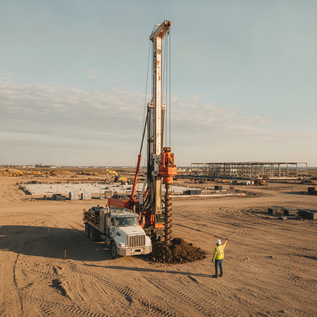
The core of the investigation is the subsurface exploration program, which typically involves drilling soil borings and collecting samples for laboratory analysis. The scope—meaning the number, depth, and location of borings—is not arbitrary. It is strategically planned based on the preliminary study, the proposed building footprint, anticipated structural loads, and the site’s geological complexity. For a large data center, a grid pattern of borings is often established across the main building pad, with additional borings at locations for ancillary structures like cooling plants, generator yards, and water storage tanks. The depth of the borings must extend well below the zone of influence of the foundation loads to encounter competent material or bedrock. A common mistake is drilling too shallow, which can miss deeper, compressible soil layers that could cause long-term settlement. During drilling, a Soil boring test, such as the Standard Penetration Test (SPT), is performed at regular intervals to assess the in-situ strength and density of the soil. High-quality soil samples are also retrieved for detailed laboratory testing. This phase requires careful coordination to avoid existing underground utilities and ensure the safety of the drilling crew and site personnel.
Laboratory Testing for Key Engineering Parameters
Once soil samples are collected, they are transported to a qualified geotechnical laboratory for a battery of tests. The selection of tests is tailored to the soil types encountered and the specific design questions that need to be answered. The results of these tests provide the quantitative data needed for sophisticated civil engineering and structural analysis. Common laboratory tests for a data center project include: Moisture Content and Atterberg Limits: To classify fine-grained soils and assess their shrink-swell potential. Grain Size Analysis: To determine the distribution of sand, silt, and clay, which influences soil behavior. Consolidation Tests: To measure how much a soil sample compresses under load, which is critical for predicting foundation settlement. Shear Strength Tests: To determine the soil’s ability to resist shear forces, a key parameter for calculating bearing capacity and slope stability. Corrosivity and Resistivity Tests: To assess the potential for soil to corrode buried steel and concrete, informing material selection for utilities and foundations. The data from these tests forms the backbone of the final Geotechnical soil report.
Integrating Geotechnical Findings into Civil and Structural Design
The ultimate value of the geotechnical investigation lies in its final product: the Geotechnical soil report. This comprehensive document does more than just present data; it provides professional engineering analysis and clear, actionable recommendations. For the structural engineer, the report will specify allowable foundation bearing pressures, estimate settlement, and provide parameters for designing either shallow foundations (like mat slabs) or deep foundations (like piles or drilled shafts). For the civil engineering team, the report is equally vital. It provides recommendations for site grading, including the suitability of on-site soils for use as structural fill and specifications for soil compaction. It also informs pavement design for heavy-duty access roads and parking areas capable of handling construction traffic and fuel delivery trucks. Furthermore, the report’s findings on soil permeability and groundwater levels are essential for designing effective stormwater management systems, such as infiltration basins or underground detention systems.
Navigating Site Access and Logistical Challenges
Executing a field exploration program on a potential data center site requires careful logistical planning. Drill rigs are large, heavy pieces of equipment that need stable, cleared access paths. On undeveloped sites, this may require preliminary clearing and grading. On previously developed or active sites, coordination is needed to avoid disrupting existing operations and, most importantly, to identify and avoid all underground utilities before drilling begins. A utility locating service is a mandatory prerequisite to any drilling activity. The project schedule must also account for the time required for the investigation. A multi-phase investigation, from desktop study to final report, can take several weeks or even months, depending on the project’s scale and complexity. This timeline must be integrated into the overall site development schedule to ensure that foundation design is not delayed. Weather can also be a significant factor, as heavy rain can make a site inaccessible to drilling equipment, requiring flexibility in the schedule.
The RSP Engineers Approach to Geotechnical Planning
At RSP Engineers, we approach Geotechnical Engineering for data centers with a risk-based methodology. Our process begins with a deep dive into the project’s specific requirements, including structural loads, settlement tolerances, and operational risk profile. We believe a phased approach is most effective, starting with a comprehensive desktop study to identify major risks before committing to an extensive and costly field program. Our team of experienced engineers and geologists then designs a tailored subsurface exploration and laboratory testing plan. We focus on gathering the precise data needed for efficient and safe design, avoiding both under-investigation (which creates risk) and over-investigation (which adds unnecessary cost). Our final deliverable is not just a data dump but a clear, concise Geotechnical soil report with practical recommendations that integrate seamlessly with the work of the civil, structural, and construction teams. We provide ongoing consultation to help the design team interpret and apply our findings throughout the site plan design and construction phases.
Common Issues in Data Center Geotechnical Investigations
Several common pitfalls can compromise the quality and usefulness of a geotechnical investigation for a data center. One of the most frequent is an insufficient number or depth of soil borings, which can lead to an incomplete picture of the subsurface and miss critical problematic soil layers. Another issue is failing to adequately investigate groundwater conditions, which can lead to major construction challenges and long-term moisture problems if not properly addressed in the design. Misinterpreting laboratory data or applying generic recommendations without considering the specific loads and performance requirements of a data center can also lead to inadequate foundation design. Finally, a lack of communication between the Geotechnical engineer, the structural engineer, and the civil engineer can result in a disconnect between the geotechnical recommendations and the final design. A collaborative approach is essential to ensure the investigation’s findings are correctly implemented.
Partner with RSP for Your Mission-Critical Geotechnical Needs
Planning and executing a successful data center project requires a team of experts who understand the stakes. The geotechnical investigation is a critical path item that informs major design and budget decisions. The team at RSP Engineers provides comprehensive site engineering services, including expert Geotechnical Engineering and subsurface investigations tailored for mission-critical facilities. We help clients navigate complex site conditions, optimize foundation design, and de-risk their investments. Our integrated approach ensures that geotechnical findings are seamlessly incorporated into the overall civil engineering and permitting strategy, setting your project on a solid foundation from day one.
Conclusion: A Foundation for Digital Infrastructure
A well-planned and executed geotechnical investigation is an indispensable investment in the success of any data center project. It moves beyond a simple compliance exercise to become a powerful tool for risk management, design optimization, and cost control. By providing a clear understanding of subsurface conditions, the Geotechnical soil report empowers the entire project team to design and build a resilient, reliable, and secure facility. For developers of digital infrastructure, ensuring a solid foundation is the first and most critical step in building for the future.
FAQs
-
There is no fixed number. The quantity of borings depends on the size of the proposed structures, the complexity of the site’s geology, and local building code requirements. A large data hall might require one boring at each corner and one in the center as a starting point, with additional borings for ancillary structures. A qualified Geotechnical engineer will determine the appropriate number based on a preliminary site assessment.
-
A Soil Test is a specific procedure performed in a laboratory to measure a single property of a soil sample, like its moisture content or strength. A Geotechnical soil report is a comprehensive engineering document that synthesizes the results of many different field explorations (like the Soil boring test) and laboratory tests. The report includes analysis, conclusions, and professional recommendations for design and construction.
-
A thorough investigation requires time and should be factored into the early stages of the project schedule. A typical investigation can take 4 to 8 weeks from notice-to-proceed to the delivery of the final report. Delays can occur due to site access issues, weather, or complex laboratory testing. Planning for it early in the due diligence or design phase is critical to avoid delaying the overall site development timeline.