
Karst and Sinkhole Risk on Data Center Projects
A guide for data center developers on identifying, investigating, and mitigating karst and sinkhole risks. Learn about geotechnical surveys, foundation design, and stormwater strategies.
Understanding Karst Topography and Geohazards
Karst is a type of landscape formed from the dissolution of soluble bedrock, such as limestone, dolomite, and gypsum. Over thousands of years, slightly acidic groundwater seeps through fractures in the rock, slowly dissolving it and creating a complex network of underground conduits, caves, and voids. This process weakens the overlying soil and rock, creating significant risks for surface structures. The most well-known hazard is sinkhole formation, which can occur gradually through subsidence or suddenly and catastrophically through a cover collapse. The primary risks to a data center development in karst terrain include differential settlement, where parts of a foundation settle at different rates, causing stress on the structure, and outright foundation failure due to the collapse of an underlying void. These issues can compromise the precise alignment of sensitive equipment, damage critical utility connections, and threaten the structural integrity of the entire facility. Therefore, a thorough understanding of the site-specific geology is a non-negotiable first step in the site development process.
Initial Site Screening and Desktop Analysis
Comparison of Karst Investigation Methods
| Method | Primary Application | Key Advantages | Limitations |
|---|---|---|---|
| Desktop Geological Review | Initial site screening and due diligence | Low cost; rapid assessment of regional risk. | Not site-specific; cannot confirm presence of voids. |
| Electrical Resistivity Tomography (ERT) | Mapping subsurface anomalies across large areas | Excellent for detecting deep voids, pinnacled rock, and clay-filled depressions. | Requires calibration with borings; data interpretation is complex. |
| Ground Penetrating Radar (GPR) | Detecting shallow subsurface features and voids | High resolution for near-surface targets; rapid data acquisition. | Limited depth penetration, especially in clayey soils. |
| Standard Penetration Test (SPT) Borings | Assessing soil properties and depth to rock | Provides direct soil samples; industry-standard method for soil characterization. | Provides data only at discrete points; can miss voids between borings. |
| Rock Coring | Evaluating bedrock quality and integrity | Provides a physical sample of the rock for direct inspection and lab testing. | Expensive; provides data only at the specific core location. |
Before committing significant resources to a site, a preliminary screening is a critical due diligence step. This desktop analysis involves reviewing publicly available data to identify red flags for karst activity. Geotechnical engineer teams and Civil engineers consult national and regional geological maps, which delineate areas with known soluble bedrock formations. These resources provide a high-level overview of potential risk. Further investigation includes analyzing aerial photography and topographic surveys for characteristic karst features, such as closed depressions, disappearing streams, and existing sinkholes in the vicinity. This initial phase of due diligence helps filter potential sites and prioritizes where more intensive, on-the-ground investigation is required. It is a cost-effective way to manage risk early in the site selection process, allowing developers to avoid sites with insurmountable geological challenges or to properly budget for necessary mitigation measures.
Advanced Subsurface Investigation Techniques
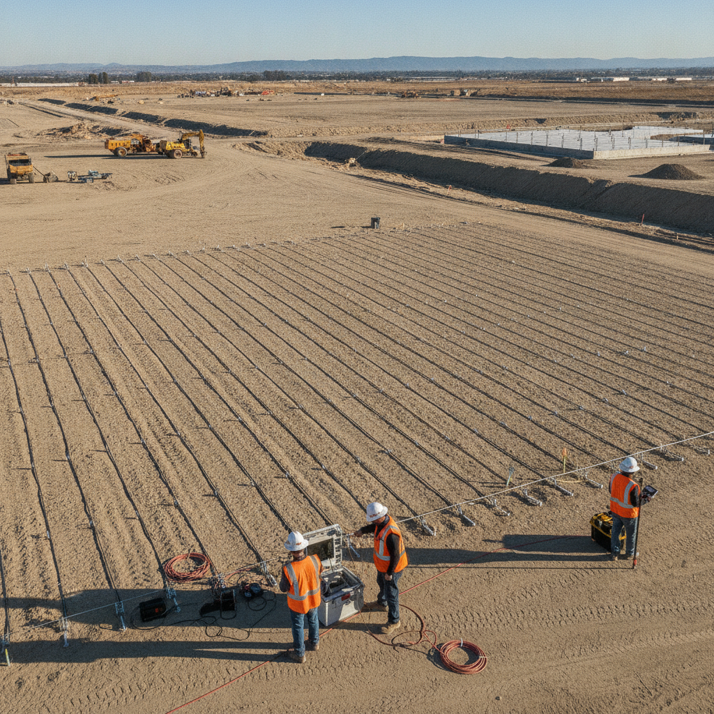
Once a site is identified as having potential karst risk, a detailed subsurface investigation is necessary to characterize the underground conditions. This phase often begins with non-invasive geophysical surveys, which provide a broad picture of subsurface anomalies without extensive drilling. Methods like Electrical Resistivity Tomography (ERT) measure variations in the electrical properties of soil and rock, effectively highlighting potential voids, clay-filled depressions, or pinnacled bedrock surfaces that are indicative of karst activity. Another common method is Ground Penetrating Radar (GPR), which is effective for identifying shallower anomalies. These geophysical methods are powerful tools for mapping potential problem areas across a large site, allowing for more strategic placement of subsequent invasive testing. The specific requirements for a geotechnical investigation and subsequent reporting can vary by jurisdiction, and it is essential to confirm all standards with the local, state, and federal authorities overseeing the project. This ensures that the investigation meets all regulatory and building code compliance standards for the proposed development.
Geotechnical Drilling and Direct Observation
While geophysical surveys are excellent for broad-area screening, they must be confirmed with direct physical data. This is achieved through a targeted geotechnical drilling program. A soil boring test, often using the Standard Penetration Test (SPT) method, is performed to assess the density and consistency of the overlying soils. When the drill encounters refusal or inconsistent resistance, it can indicate a highly irregular or pinnacled bedrock profile, a key indicator of karst. To directly assess the quality of the bedrock itself, rock coring is performed. This technique retrieves a solid cylinder of rock, allowing geologists and engineers to visually inspect it for fractures, solution-widened joints, and evidence of voids. By drilling at a sufficient density across the proposed building and infrastructure footprints, the project team can create a detailed 3D model of the subsurface, identifying high-risk zones that require mitigation and stable zones suitable for foundation support. This direct data is crucial for a reliable Geotechnical soil report.
Foundation Design and Mitigation Strategies in Karst Terrain
If a geotechnical investigation confirms significant karst risk, the engineering team must develop appropriate mitigation and foundation strategies. The goal is to ensure the long-term stability of the data center structure. One common approach is the use of deep foundations, such as micropiles or drilled shafts, which are driven or drilled through the unstable soil and weathered rock layers to bear on competent, solid bedrock at depth. This effectively bypasses the problematic karst features. Another strategy is to use a heavily reinforced mat foundation, which acts as a rigid slab to bridge over potential small voids and distribute the building’s load over a wider area, reducing the risk of localized settlement. In areas with identified voids, compaction grouting or other ground improvement techniques may be employed. This involves injecting a stiff grout mixture into the subsurface to fill voids, densify loose soils, and create a more stable foundation subgrade. The choice of strategy depends on the specific subsurface conditions, the building’s load requirements, and the project budget.
Stormwater Management and Utility Design Considerations
A critical and often overlooked aspect of site development in karst regions is stormwater management. Concentrating the infiltration of stormwater runoff can accelerate the dissolution of underlying bedrock and trigger sinkhole formation. Therefore, typical low-impact development (LID) strategies that rely on infiltration basins or dry wells are generally unsuitable and can be dangerous in active karst terrain. This requires careful planning and close utility coordination. The preferred approach to drainage design is to collect stormwater in sealed systems, such as concrete channels or lined pipes, and convey it to lined detention ponds. These ponds are designed with an impermeable liner to prevent water from seeping into the ground. From the pond, water is discharged at a controlled rate to a stable, off-site location. This method manages runoff volume and rate as required by local regulations without introducing water into the sensitive subsurface environment, protecting the long-term integrity of the site.
RSP Engineers’ Approach to Karst Risk Assessment
At RSP Engineers, we employ a systematic, phase-based approach to help clients navigate the complexities of data center development in karst-prone areas. Our process is designed to identify risks early and develop cost-effective, reliable solutions. We begin with a comprehensive desktop study and site screening to assess feasibility. This is followed by a tailored subsurface investigation program, integrating advanced geophysical methods with targeted geotechnical drilling to build a clear picture of the site’s geology. Our team of Civil engineers and geotechnical specialists then analyzes this data to inform robust foundation design, stormwater management plans, and any necessary ground improvement measures. We provide end-to-end support, from initial permitting through construction administration, ensuring the final design is implemented correctly and the facility is built on a secure foundation.
Common Pitfalls in Karst Site Development
Developing on karst terrain is fraught with potential challenges that can derail a project if not managed proactively. One of the most common mistakes is inadequate due diligence, where a team proceeds with a site based on incomplete or overly optimistic geological data. Another pitfall is over-reliance on a single investigation method; geophysical data, for example, is a powerful tool but must be calibrated and confirmed with physical borings. Improper stormwater management design that allows for concentrated infiltration is a frequent and dangerous error. Finally, failing to budget for potential ground improvement or specialized foundations can lead to significant cost overruns and construction delays when unforeseen conditions are encountered during excavation.
Partner with RSP Engineers for Your Mission-Critical Project
Navigating the geological and regulatory complexities of a data center project in karst terrain requires specialized expertise. The team at RSP Engineers provides comprehensive civil engineering and site development services tailored for mission-critical facilities. We manage every phase, from initial due diligence and geotechnical investigation to specialized foundation design, stormwater management, and navigating the complex permitting process. Our proactive approach to risk mitigation ensures your project is built on a solid, secure, and reliable foundation. Contact us to discuss how we can support your next development.
Conclusion: Proactive Geotechnical Strategy is Key
The presence of karst terrain introduces significant challenges to data center development, but these challenges are manageable with a proactive and technically sound approach. A thorough understanding of the site’s subsurface conditions, achieved through a multi-phased geotechnical investigation, is the cornerstone of a successful project. By integrating this knowledge into a robust foundation design and a cautious stormwater management plan, developers can confidently build and operate secure, long-lasting facilities. Ultimately, investing in expert civil engineering at the outset is the most effective way to mitigate risk and protect the immense value of a mission-critical asset.
FAQs
-
During construction, crews should be vigilant for signs like circular or linear cracking in the ground, localized depressions or slumping, turbid water in excavations after a rain event, or a sudden loss of drilling fluid during foundation work. Any of these indicators warrant an immediate stop-work order and a thorough geotechnical evaluation.
-
Yes, in many cases. The key is to quantify the risk through a comprehensive geotechnical investigation and implement appropriate engineering solutions. Mitigation strategies like deep foundations, reinforced mat slabs, or compaction grouting can create a safe and stable site for a mission-critical facility, though these solutions will impact the project budget.
-
Karst risk can significantly impact both. The budget must account for extensive Geotechnical Engineering studies, potentially expensive ground improvement measures, and more robust foundation designs. The timeline may be extended by the need for detailed investigations and the execution of mitigation work, such as grouting programs, before vertical construction can begin.