
How Topography Influences Data Center Site Selection
Explore how topography, grading, and drainage impact data center site selection. Learn how expert civil engineering analysis mitigates risks related to earthwork, floodplains, and utility routing.
Earthwork and Grading: The Foundation of Site Viability
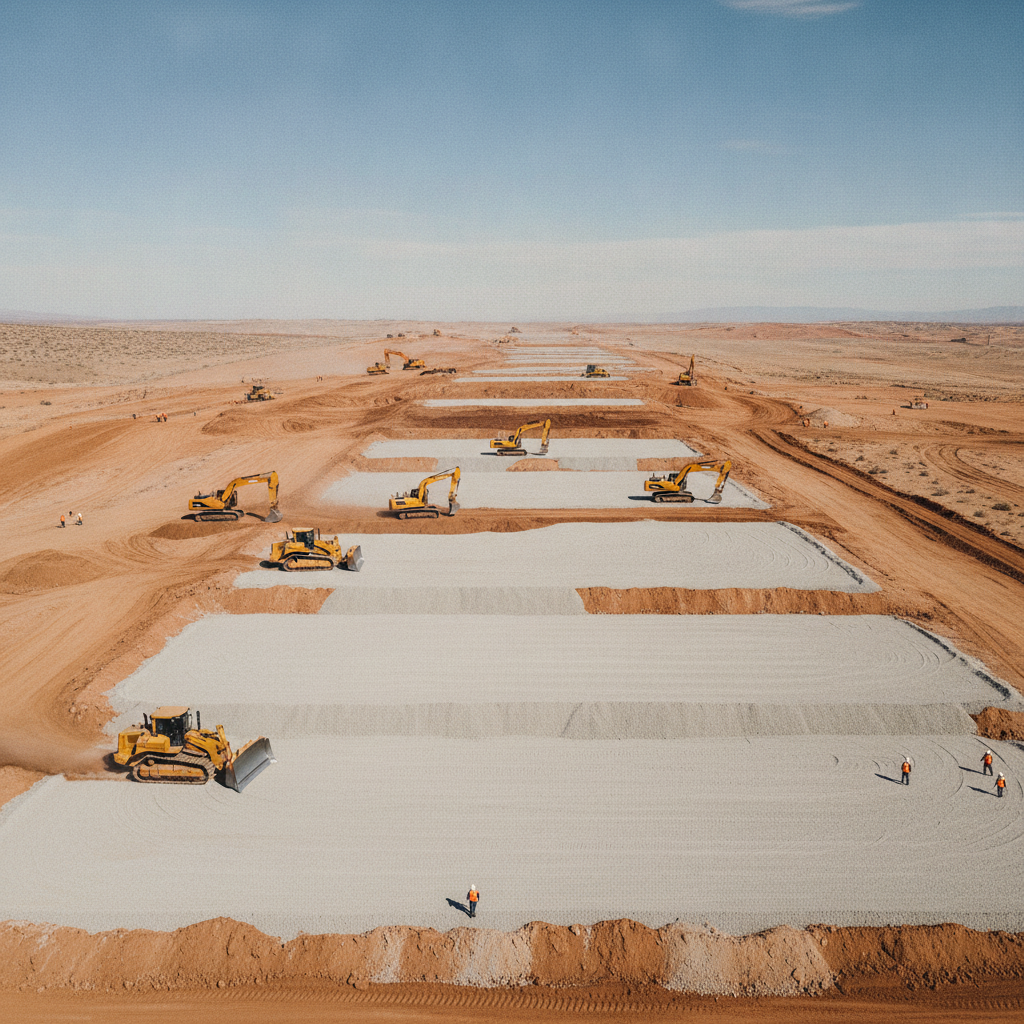
The ideal data center sits on a large, level pad. Achieving this on a site with varied topography requires significant earthwork—the process of moving soil and rock to create the desired grades. The primary goal is to achieve a ‘balanced site,’ where the amount of soil excavated (cut) equals the amount needed for fill. A balanced site minimizes the costly process of importing fill material or hauling excess soil off-site. The site’s natural slopes directly dictate the volume of earthwork required. Even gently rolling terrain can translate to hundreds of thousands of cubic yards of soil movement for a large data center campus. A thorough civil engineering analysis involves creating a preliminary grading plan to quantify these volumes. This model helps developers understand the true cost of site preparation. Steep slopes not only increase earthwork quantities but also introduce challenges like soil stability, the need for phased grading operations, and potentially longer haul roads, all of which impact the construction schedule. Understanding the site’s topographical DNA is the first step in an effective site development strategy.
Stormwater Management and Drainage Design Challenges
Topographical Feature Impact Analysis for Data Center Sites
| Topographical Feature | Earthwork & Grading Impact | Stormwater & Drainage Complexity | Utility Installation Considerations |
|---|---|---|---|
| Relatively Flat Terrain (<2% slope) | Minimal cut/fill required. Low earthwork costs. Ideal for achieving a balanced site. | Low runoff velocities. Simple gravity-fed systems are often feasible. Requires careful design to ensure positive drainage. | Shallow, consistent trench depths. Straightforward routing for gravity sewer and other utilities. |
| Gently Rolling Terrain (2-8% slope) | Moderate earthwork volumes. Good potential for a balanced site by cutting from high points to fill low areas. | Moderate runoff velocities. May require energy dissipators. Pond locations are often naturally defined in low areas. | Varying trench depths. Potential for gravity systems is good but requires careful analysis of flow lines. |
| Steeply Sloped Terrain (>8% slope) | High earthwork volumes. High risk of unbalanced site (excess cut or fill). Increased erosion control costs. | High runoff velocities requiring robust controls (riprap, check dams). Complex conveyance systems. Limited pond locations. | Deep, difficult excavations. High potential for needing lift stations for sewer. Retaining walls may be needed to support utility corridors. |
| Low-Lying / Depressional Areas | Significant fill import may be required to raise pads above flood levels. Potential for unsuitable, wet soils. | Can serve as natural locations for retention ponds, but may have outfall elevation issues. High groundwater can complicate construction. | Dewatering may be required for trenching. Risk of utility flotation if not properly anchored. High flood risk for underground vaults. |
| Terraced or Benched Site | Requires significant, precise grading. Often necessitates retaining walls between terraces, increasing structural costs. | Drainage must be managed at multiple elevations, requiring drop structures and complex piping networks. | Utility routing must navigate vertical grade changes, potentially requiring deep manholes or specialized conduit runs. |
Topography governs how water moves across a site. Existing valleys, swales, and ridges form the natural drainage network that a civil engineer must work with—or redesign. The development of large, impervious surfaces like building roofs and parking lots dramatically increases the volume and velocity of stormwater runoff. A robust stormwater management system is required to collect, convey, treat, and safely discharge this runoff without causing downstream flooding or erosion. The site’s high and low points determine the feasibility and location of critical infrastructure like detention or retention ponds and the ultimate outfall where water leaves the site. A site with a low outfall elevation relative to the proposed development area provides favorable conditions for a gravity-fed drainage system. Conversely, a site without a clear, low-elevation discharge point may require complex and costly engineering solutions. Drainage design criteria and permitting requirements vary by jurisdiction, and it is crucial to confirm all applicable standards with the local, state, regional, and federal authorities that hold review authority over the site. Proper drainage design and erosion and sediment control are fundamental to a successful project.
Flood Risk and Finished Floor Elevation (FFE)
A site’s elevation is its primary defense against flooding. During due diligence, a critical step is to review Federal Emergency Management Agency (FEMA) flood maps to identify any special flood hazard areas. Low-lying portions of a property may fall within a 100-year or 500-year floodplain, which can severely restrict development or impose stringent design requirements. For a mission-critical facility like a data center, avoiding flood risk is paramount. The civil engineering team must establish a minimum Finished Floor Elevation (FFE) for all structures, typically set a margin above the Base Flood Elevation (BFE) as required by local codes. Topography dictates how much fill is needed to elevate the building pads to this safe elevation. A site that is naturally high and dry is far more desirable and less costly to develop than a low-lying parcel that requires massive amounts of imported fill to lift it out of the floodplain. This analysis is a core component of floodplain management and risk mitigation for any site development project.
Utility Infrastructure and Topographical Constraints
While the availability of power and fiber is a primary driver, the site’s topography significantly impacts the cost and complexity of bringing those utilities to the building. Gravity-dependent utilities, particularly sanitary sewer and some storm drains, are highly sensitive to elevation. A site that slopes gently towards the public sewer main allows for an efficient, low-maintenance gravity connection. If the building pad is lower than the connection point, a costly and maintenance-intensive lift station will be required to pump wastewater uphill. Other utilities like water, gas, and telecommunications are pressurized and less constrained by gravity, but steep slopes and rocky terrain can still make trenching and installation difficult and expensive. Effective utility coordination requires a site plan design that considers the most efficient routing based on the existing topography, minimizing deep excavations, rock removal, and conflicts with other infrastructure. These are key considerations for any site engineering services provider.
Retaining Walls and Structural Site Elements
When grade changes are too abrupt to be managed with sloped earth, retaining walls become necessary. These structural elements are used to create level terraces for building pads, parking lots, and access roads on steeply sloped sites. While effective, retaining walls add significant cost to a project, not only for the walls themselves but also for the associated Geotechnical Engineering analysis, structural design, and specialized construction. The decision to use retaining walls is a direct consequence of the site’s topography and the development program’s needs. A site that requires extensive, tall retaining walls may have less usable area and a more complex permitting pathway. The Geotechnical soil report is critical in this context, as it informs the design of wall foundations and ensures the retained soil is stable. Balancing the need for level space with the cost of structural solutions is a key challenge in developing topographically complex sites.
RSP Engineers’ Approach to Topographical Analysis
At RSP Engineers, our process for evaluating site topography is rigorous and data-driven, designed to identify risks and opportunities early in the due diligence phase. We begin with a desktop analysis using publicly available data like USGS topographic maps and LiDAR to get a preliminary understanding of the site’s characteristics. This initial screen helps us flag obvious challenges before committing to more intensive investigation. If the site shows promise, we recommend a detailed ALTA/NSPS Land Title Survey combined with a comprehensive topographic survey. This provides the high-resolution data needed for accurate engineering analysis. Concurrently, we manage a Geotechnical Engineering investigation, including soil boring test work, to understand the subsurface conditions in relation to the surface topography. This data feeds into our civil engineering models, where we develop conceptual grading plans and earthwork calculations. This allows our clients to make informed decisions based on a clear picture of the site preparation costs and construction complexities long before breaking ground.
Common Topographical Challenges in Site Development
Even with careful planning, developing a site with challenging topography can present several common issues. An unbalanced earthwork scenario, where a site has far more cut than fill (or vice versa), can lead to unexpected and substantial costs for soil disposal or import. Another frequent challenge is the lack of a viable gravity outfall for the stormwater management system, forcing the design to incorporate costly pumping systems or complex conveyance routes. During grading, crews may encounter unforeseen conditions like shallow rock or unsuitable soils that were not fully identified in the Geotechnical soil report, halting progress and requiring expensive remediation. Finally, ensuring the entire site, including pedestrian pathways between buildings and parking areas, meets ADA compliance can be exceptionally difficult on steeply sloped properties, requiring long, winding ramps or additional retaining walls that were not in the original budget.
Your Partner in Mission-Critical Site Development
Navigating the complexities of topography requires a civil engineering partner with deep experience in large-scale site development. RSP Engineers provides comprehensive due diligence, design, and permitting services for mission-critical facilities nationwide. Our team excels at identifying topographical risks and opportunities, delivering optimized site plan design solutions that balance performance with cost-effectiveness. From initial feasibility studies and utility coordination to final construction administration, we ensure your project is built on a solid foundation. Contact us to discuss how we can support your next data center project.
Conclusion
While power and fiber may get the headlines, topography is the silent partner in every data center development. The contours of the land fundamentally shape the project’s design, budget, and schedule. A proactive approach that prioritizes a thorough topographical analysis during the earliest stages of site selection is the best way to mitigate risk and set a project up for success. By understanding the implications of earthwork, drainage, and elevation, developers can avoid costly surprises and make smarter investment decisions. Expert civil engineering and site development planning are not expenses; they are essential investments in the long-term viability of a mission-critical facility.
FAQs
-
Topography is one of the largest variables in site development costs. A flat, well-drained site might have minimal preparation costs, while a steep, rocky site could require millions of dollars in earthwork, retaining walls, and complex utility infrastructure before the foundation can even be poured. This can represent a significant percentage of the total project budget.
-
A ‘balanced site’ is one where the volume of soil excavated (cut) during grading is approximately equal to the volume of soil needed for embankments (fill). This is the most cost-effective scenario because it minimizes the need to pay for hauling soil off-site or trucking in expensive engineered fill. Achieving a balanced site is a primary goal of an efficient grading plan.
-
Yes, but with significant caveats. A steeply sloped site can be viable if other factors (like proximity to power and fiber) are exceptionally strong. However, the developer must be prepared for higher site development costs, a longer construction schedule, and the potential need for extensive retaining walls and complex stormwater management systems. A thorough feasibility study is critical.