
What is a Hydrologic Study? A Florida Land Development Perspective
Learn what a hydrologic study is, why it’s critical for Florida land development, and how it impacts stormwater management, permitting, and drainage design. Expert insights from RSP Engineers.
The Core Components of a Hydrologic Analysis
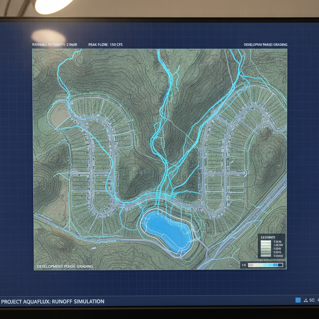
A comprehensive hydrologic study is built upon several key technical components that work together to create a complete picture of a site’s water dynamics. The first is an analysis of rainfall data, where engineers select specific design storm events (e.g., a 25-year, 24-hour storm) as defined by agencies like the Florida Water Management Districts. This establishes the volume of water the site must be designed to handle. Next is watershed delineation, which involves mapping the boundaries of the drainage basins that contribute runoff to and within the project site. This is crucial for understanding both on-site and off-site flows. Engineers then determine the runoff coefficients for different surfaces. An asphalt parking lot has a high coefficient (generating significant runoff), while a grassy field has a low one (allowing for more infiltration). The analysis also calculates the time of concentration—the time it takes for water to travel from the most hydraulically distant point of a watershed to the outlet. These factors are synthesized using established engineering methods to predict the peak flow rates and total runoff volumes that the drainage design must accommodate.
Hydrologic vs. Hydraulic Modeling: Understanding the Difference
Comparison of Pre-Development vs. Post-Development Hydrologic Factors
| Factor | Pre-Development Condition | Post-Development Condition | Engineering Implication |
|---|---|---|---|
| Runoff Coefficient (Curve Number) | Low (e.g., 0.2-0.4 for vegetated areas) | High (e.g., 0.9 for pavement/roofs) | Significantly more rainfall becomes direct runoff, increasing the burden on the drainage system. |
| Time of Concentration | Longer (water travels slowly over natural ground) | Shorter (water travels quickly through pipes and gutters) | Runoff reaches the outlet faster, resulting in a higher, more intense peak discharge rate. |
| Peak Discharge Rate | Lower | Higher (without mitigation) | The primary driver for designing attenuation ponds to capture and slow down this increased flow. |
| Total Runoff Volume | Lower (more infiltration into the soil) | Higher (less infiltration due to impervious surfaces) | Requires stormwater facilities to store the excess volume or promote infiltration on-site. |
| Infiltration Capacity | High (natural soils absorb rainfall) | Low (compacted soils and impervious cover prevent absorption) | Necessitates water quality treatment systems and retention/detention ponds to compensate for lost natural function. |
In the world of civil engineering, the terms hydrology and hydraulics are often used together but describe two distinct functions. Hydrology is the study of the quantity and timing of water flow. It answers the question, “How much water will reach this point and when?” The output of a hydrologic model is typically a hydrograph, a graph showing the rate of flow over time. This analysis determines the total volume and peak flow rate of stormwater runoff a site will generate. Hydraulics, on the other hand, focuses on the physical conveyance of that water. It answers the question, “How will this amount of water move through our pipes, channels, and ponds?” A hydraulic model analyzes the capacity of the proposed conveyance systems, calculating water surface elevations, velocities, and the hydraulic grade line (HGL). Software like ICPR or HEC-RAS is used to ensure that pipes are sized correctly, culverts do not overtop roadways, and channels have adequate capacity, preventing flooding within the development. A project requires both a robust hydrologic analysis and a precise hydraulic model for a complete stormwater management system design.
Regulatory Drivers: Why Florida Water Management Districts Mandate These Studies
In Florida, hydrologic studies are not optional; they are mandated by powerful regulatory bodies, most notably the state’s Water Management Districts (WMDs), such as the South Florida Water Management District (SFWMD) and the St. Johns River Water Management District (SJRWMD). The primary goal of these agencies is to prevent adverse impacts from development. This includes preventing localized and regional flooding, protecting water quality, and preserving natural ecosystems. The permitting process, specifically the Environmental Resource Permit (ERP), hinges on the results of the hydrologic study. WMD criteria typically require that the post-development runoff does not exceed the pre-development runoff in terms of peak discharge rate and, in many cases, total volume. This “no adverse impact” standard is the driving force behind the design of most stormwater ponds and other Best Management Practices (BMPs). The study must demonstrate compliance with specific criteria for water quality treatment (removing pollutants) and flood attenuation. A thorough and defensible hydrologic study is the cornerstone of a successful permit submittal.
Data Collection: The Foundation of an Accurate Study
The principle of “garbage in, garbage out” applies perfectly to hydrologic modeling. The accuracy of the study is entirely dependent on the quality of the input data. The process begins with a high-resolution topographic survey, often supplemented with LiDAR data, to create a precise digital elevation model of the site. This model is essential for delineating drainage basins and determining flow paths. Another critical dataset is soil classification from the USDA’s Natural Resources Conservation Service (NRCS), which defines the soil’s hydrologic group and its capacity for infiltration. For redevelopment projects, accurate as-built information of existing infrastructure is vital. This requires extensive utility coordination to locate underground pipes, culverts, and inlets that could affect water flow. Existing land use maps and aerial imagery are used to define the pre-development conditions accurately. A failure to gather comprehensive data at the outset can lead to flawed models, extensive agency review comments, and costly design revisions late in the process.
Key Outputs and Their Impact on Site Design
The final report of a hydrologic study provides critical outputs that directly shape the physical layout of a development. The most important of these are the calculated peak discharge rates and runoff volumes for various design storms. These numbers are not abstract; they are the basis for the entire drainage design. For example, the required storage volume for a detention pond is calculated directly from the hydrographs generated by the model. The goal is to capture the excess runoff from new impervious surfaces (roofs, pavement) and release it slowly over time. These outputs also dictate infrastructure sizing. The calculated peak flow determines the required diameter of storm sewer pipes, the dimensions of roadside swales, and the size of culverts under driveways and roads. The hydrologic study can even influence the overall site development plan, as engineers may need to allocate significant land area for stormwater ponds or green infrastructure to meet regulatory requirements, impacting the project’s yield and financial viability.
The Role of Hydrologic Studies in Floodplain Management
Beyond on-site stormwater management, hydrologic studies play a crucial role in floodplain management, particularly concerning Federal Emergency Management Agency (FEMA) flood maps. These maps designate Special Flood Hazard Areas and establish the Base Flood Elevation (BFE), which has significant implications for building requirements and flood insurance rates. A detailed site-specific hydrologic and hydraulic analysis can be used to challenge or refine FEMA’s findings. If a study demonstrates that a property was incorrectly included in a floodplain, a Professional Engineer can prepare a Letter of Map Amendment (LOMA) to have it officially removed. If a project’s grading and infrastructure improvements will change the floodplain, a Letter of Map Revision (LOMR) is required. This process involves complex modeling to show that the project will not cause an adverse rise in floodwaters on adjacent properties. Successfully navigating the LOMA or LOMR process can add significant value and utility to a property, making the hydrologic study a powerful financial tool.
Our Process: From Initial Data Gathering to Final Permit Approval
At RSP Engineers, we approach every hydrologic study with a systematic and rigorous process. It begins with Project Kickoff and Data Acquisition, where we work with the client to gather all available information, including boundary and topographic surveys, environmental assessments, and project goals. We supplement this with publicly available GIS data, historical rainfall records, and soil maps to build a complete baseline. The next phase is Model Setup and Calibration, where our engineers select the appropriate software (like AdICPR or HEC-HMS) and build a digital model representing the site’s unique characteristics, carefully delineating drainage basins and assigning parameters. The core of our work is the Analysis and Iteration phase. We run simulations for all required design storms under both pre-development and post-development scenarios. This allows us to test various drainage design alternatives, optimizing the size and location of ponds, swales, and pipes to meet regulatory requirements efficiently. Finally, we move to Reporting and Permit Submittals. We compile a clear, comprehensive report with all necessary calculations, maps, and exhibits, presenting a defensible case to the reviewing agency to facilitate a smooth and timely permit approval.
Common Pitfalls in Hydrologic Modeling and Permitting
Even with sophisticated software, hydrologic modeling is subject to potential errors that can delay projects. One of the most common pitfalls is relying on inaccurate or outdated topographic data, which can lead to incorrect watershed delineations and flawed results. Another issue is making improper assumptions for key parameters like runoff coefficients or infiltration rates without field verification. This is a frequent point of contention during agency review and can trigger requests for additional information (RAIs). Failing to properly account for off-site contributing areas—or “run-on”—is another critical error. This can lead to undersized systems that are quickly overwhelmed. Finally, a poorly written or disorganized report can make it difficult for agency reviewers to follow the engineer’s methodology, leading to unnecessary questions and delays. A successful project requires not only sound engineering but also clear communication and documentation throughout the permitting process.
Partner with RSP Engineers for Your Florida Hydrologic Study
A hydrologic study is the backbone of a successful land development project in Florida. Navigating the complexities of WMD criteria, accurate modeling, and the permitting process requires deep expertise. The team at RSP Engineers provides comprehensive civil engineering services, specializing in stormwater management and drainage design. We leverage advanced modeling software and decades of experience to deliver accurate, defensible hydrologic studies that pave the way for smooth agency review and project approval. Contact our team today to discuss your project’s specific needs and ensure your development is built on a sound engineering foundation.
Conclusion: The Critical Role of Hydrology in Successful Land Development
Ultimately, a hydrologic study is far more than a technical report filled with calculations and maps. It is a strategic tool for risk management, ensuring a development will not cause flooding, degrade water quality, or create future liabilities. For any developer in Florida, a well-executed study is a critical investment that informs intelligent site development, protects property values, and satisfies the stringent requirements of the state’s regulatory agencies. By prioritizing a thorough and accurate analysis upfront, you set the stage for a successful permitting process and a resilient, high-quality final product. This foundational work is essential for any project’s long-term success in Florida’s unique environment.
FAQs
-
The fundamental principles are the same, but the scale and complexity differ greatly. A small commercial site may have one or two simple drainage basins feeding a single dry retention pond. A large residential subdivision involves a complex network of interconnected basins, phased construction, roadway drainage systems, and often multiple large, wet detention ponds that require more intricate stormwater management modeling and master planning.
-
A design storm is a statistical, hypothetical rainfall event of a specific magnitude and duration used for engineering design. A “25-year storm” has a 4% chance of occurring in any given year, while a “100-year storm” has a 1% chance. Different design storms are used to design and test different aspects of a drainage design. For example, water quality treatment might be based on a smaller, more frequent storm, while major culverts and floodplains are analyzed against the 100-year event to ensure public safety.
-
Sometimes, but it requires careful review and recertification by a Professional Engineer. An older study may be invalid if regulatory criteria have changed, if the site’s topography has been altered, or if the underlying rainfall data has been updated by agencies like NOAA. Any new development plan will necessitate, at a minimum, an updated post-development analysis to reflect the proposed changes and ensure compliance with the current Florida Building Code and WMD rules.