
Decoding Development Density: A Guide to Floor Area Ratio (FAR) and Lot Coverage in Florida
A Florida civil engineering guide to understanding Floor Area Ratio (FAR) and Lot Coverage. Learn how these key zoning metrics impact site design, permitting, and project feasibility.
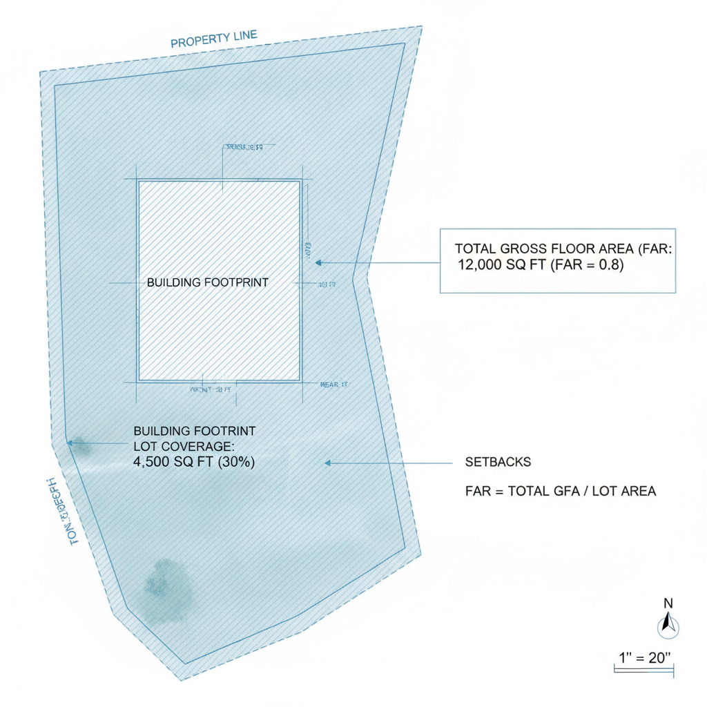
Defining the Core Concepts: Floor Area Ratio (FAR) vs. Lot Coverage
While often discussed together, FAR and Lot Coverage regulate two distinct aspects of development density. Lot Coverage is a two-dimensional control that limits the horizontal extent of a project. It is calculated as the total building footprint divided by the total lot area. This metric directly governs how much of the property can be covered by structures, thereby preserving open space, controlling impervious surfaces, and influencing the site’s overall aesthetic. A high lot coverage limit allows for sprawling, single-story buildings, while a low limit necessitates a more compact or vertical design. Floor Area Ratio, in contrast, is a three-dimensional control that regulates the total building volume or intensity. It is calculated by dividing the total gross floor area of all stories of a building by the total lot area. For example, a 10,000 square foot lot with a FAR of 1.0 allows for 10,000 square feet of total building area. This could be a single-story 10,000 sq ft building or a two-story building with 5,000 sq ft per floor. FAR is a powerful tool used by planners to manage population density, traffic generation, and the demand on public utilities, making it a cornerstone of any zoning code analysis.
The Role of FAR in Regulating Development Intensity and Scale
FAR vs. Lot Coverage: Key Distinctions for Florida Developers
| Metric | Floor Area Ratio (FAR) | Lot Coverage |
|---|---|---|
| Primary Control | Regulates total development intensity and density (a 3D measure). | Regulates the physical building footprint on the land (a 2D measure). |
| Calculation | Total Gross Floor Area of all stories / Total Lot Area. | Building Footprint Area / Total Lot Area. |
| Typical Impact On... | Infrastructure demand (utilities, traffic), population density, and overall project scale. | Stormwater runoff, available open/green space, and site layout for parking and amenities. |
| Common Exclusions | Varies by code; may exclude underground parking, open balconies, or mechanical penthouses. | Varies by code; may exclude unenclosed porches, eaves, or detached accessory structures under a certain size. |
| Strategic Consideration | Maximizing FAR is key to financial return on high-value land. Often requires vertical construction. | Minimizing coverage can simplify stormwater management and improve site aesthetics. |
| Permitting Focus | Ensures the project's scale aligns with the comprehensive plan and infrastructure capacity. | Ensures compliance with impervious surface limits and open space requirements. |
Municipalities use Floor Area Ratio as a primary lever to implement their long-term vision outlined in their comprehensive plans. By assigning different FAR limits to various zoning districts, a city can encourage high-density, mixed-use development in urban cores while preserving the low-density character of residential neighborhoods. A higher FAR is a direct indicator of greater allowable development intensity, which has significant implications for a project’s financial viability and its impact on surrounding infrastructure. For a civil engineer, FAR is a critical input for nearly every aspect of design. It dictates the scale of required utility coordination, as a higher density project places greater demand on water, sewer, and electrical systems. It also informs the scope of a required traffic impact analysis, as more floor area generally translates to more vehicle trips. Achieving zoning compliance with FAR is non-negotiable and forms the basis for all subsequent engineering and architectural design decisions.
How Lot Coverage Dictates Site Layout and Open Space
In Florida, where rainfall is frequent and intense, Lot Coverage is intrinsically linked to stormwater management. The percentage of a site covered by a building’s footprint contributes directly to the total impervious surface area. More impervious area means less natural ground for rainwater to infiltrate, leading to increased runoff that must be managed through engineered systems like retention ponds, exfiltration trenches, or underground vaults. A restrictive lot coverage limit forces designers to be more efficient with the building footprint, preserving more green space for drainage and landscaping. Beyond drainage, Lot Coverage shapes the entire site experience. It influences the space available for parking, pedestrian walkways, fire access lanes, and amenities. Strict setback compliance combined with lot coverage limits can create significant design puzzles. The resulting site layout must not only be functional but also meet local requirements for open space and landscaping, which are crucial for both aesthetic appeal and environmental performance. Effective drainage design begins with a clear understanding of the site’s lot coverage constraints.
Navigating Florida’s Municipal Variations in Zoning Codes
There is no one-size-fits-all standard for FAR and Lot Coverage in Florida. Each of the state’s 67 counties and hundreds of municipalities maintains its own unique zoning ordinance. A FAR of 2.0 might be standard for a commercial district in Miami, while a similar district in a smaller North Florida city might cap it at 0.5. This variability makes thorough, site-specific due diligence an absolute necessity before acquiring property. A developer cannot assume that rules from a neighboring jurisdiction will apply. Furthermore, many jurisdictions have overlay districts or special planning areas with unique requirements that supersede the base zoning. A historic preservation overlay, for example, might impose stricter lot coverage limits to maintain neighborhood character. Engaging a local civil engineering firm early in the process is critical to uncovering these nuances. Our team specializes in interpreting complex municipal codes and advising clients on the true development potential of a property, preventing costly surprises during the permitting process.
Calculating FAR and Lot Coverage: What’s Included and Excluded?
The devil is often in the details of how a municipality defines terms like “gross floor area” and “building footprint.” The gross floor area calculation for FAR can be complex. Some codes exclude areas like underground parking, open-air balconies, mechanical penthouses, or attic spaces with low headroom, while others count them. Similarly, the building footprint definition may or may not include structures like covered, unenclosed walkways or porte-cochères. These distinctions can add or remove thousands of square feet from a project’s potential yield. A meticulous review of the local zoning code is required to confirm these definitions. Misinterpreting what counts can lead to a design that inadvertently exceeds the allowable FAR or coverage, resulting in a notice of violation and rejected permit submittals. This is a common and avoidable pitfall. We assist clients by creating detailed zoning exhibits that clearly document these calculations, providing regulatory agencies with the confidence that the proposed design is fully compliant.
Strategic Site Design: Balancing FAR, Coverage, and Project Goals
The ultimate goal of site plan design is to achieve the client’s vision while adhering to all regulatory constraints. FAR and Lot Coverage are the primary constraints that shape the design strategy. For instance, on a site with a high FAR limit but a restrictive lot coverage limit, the logical solution is to build vertically. This approach maximizes sellable/leasable floor area while leaving ample ground space for critical site elements like parking, stormwater management facilities, and ADA-compliant pathways. Conversely, a site with generous lot coverage but a low FAR might be better suited for a single-story commercial center with extensive surface parking. Our role in site layout optimization involves exploring these scenarios. We use conceptual layouts to help clients visualize the trade-offs, balancing building efficiency with parking requirements, utility access, and drainage needs. This strategic planning phase is a form of value engineering that ensures the final design is not only compliant but also cost-effective and functional.
RSP Engineers’ Approach to Zoning Analysis and Site Feasibility
Our process begins long before any lines are drawn on a site plan. We start with a comprehensive zoning analysis and site feasibility study. This involves a deep dive into the applicable municipal and county codes to determine the exact FAR, lot coverage, setback, height, and parking requirements for a specific parcel. We identify potential red flags, such as environmental constraints, utility conflicts, or restrictive overlay districts, that could impact the development program. This upfront analysis provides our clients with a clear, data-driven understanding of the property’s maximum development yield. We present our findings in a concise feasibility report that empowers them to make informed investment decisions. This proactive approach to site development minimizes risk and establishes a clear pathway for a successful design and permitting phase, ensuring alignment between the project’s financial goals and regulatory reality.
Common Pitfalls: Misinterpreting FAR and Lot Coverage Regulations
Even experienced developers can encounter issues when navigating Florida’s diverse regulatory landscape. One common pitfall is assuming consistency between jurisdictions; the definition of “gross floor area” in Tampa may differ significantly from that in Orlando. Another frequent error is overlooking specific requirements within an overlay district that are more stringent than the underlying base zoning. This can lead to a design that is compliant with one set of rules but in violation of another. Failing to accurately calculate impervious surface areas related to lot coverage is another major issue that can trigger extensive comments from agency reviewers, particularly from water management districts. These mistakes often result in the need for a costly redesign and can delay the project timeline by months. Diligent, professional analysis is the only way to avoid these preventable and expensive errors in zoning compliance.
Partner with RSP Engineers for Expert Zoning and Site Design
Navigating the complexities of Floor Area Ratio, Lot Coverage, and overall zoning compliance is critical for a successful project in Florida. An error in calculation or interpretation can jeopardize your entire investment. Our team of Florida Licensed Engineers provides comprehensive site engineering services, from initial feasibility studies and due diligence to final construction administration. We specialize in creating optimized, compliant, and cost-effective designs that meet all regulatory requirements. Contact us today to ensure your project maximizes its potential from day one.
Conclusion: FAR and Lot Coverage as Cornerstones of Smart Development
Floor Area Ratio and Lot Coverage are more than just abstract zoning terms; they are the foundational metrics that shape the physical form and financial success of a development. They balance private development rights with the public’s interest in managed growth, infrastructure stability, and environmental quality. A proactive approach that prioritizes a thorough understanding of these rules is essential for any project in Florida. By engaging in expert civil engineering consultation early, developers can navigate the permitting process with confidence, avoid costly redesigns, and bring a successful land development project to fruition.
FAQs
-
Yes, it is possible to apply for a variance, but it is typically a challenging, expensive, and time-consuming process. You must demonstrate a unique and practical hardship associated with the property itself, not just a desire to build more. The process usually involves public hearings and is never guaranteed, making it a last resort rather than a primary strategy for achieving zoning compliance.
-
They have a direct and significant impact. Higher Lot Coverage means more building footprint and often more associated pavement, increasing the total impervious area. This generates more stormwater runoff that must be collected, treated, and attenuated on-site, often requiring larger or more complex stormwater management systems like underground vaults or wet detention ponds to meet agency requirements.
-
This depends entirely on the specific municipal zoning code. Many jurisdictions exclude structured parking from the gross floor area calculation to incentivize developers to build garages instead of expansive surface lots. However, some codes count all or a portion of it. Verifying this detail is a critical step in the due diligence process for any project with structured parking.