
Using Drone Surveys in Land Development
Explore how drone surveys enhance land development in Florida. Learn about photogrammetry, LiDAR, and their applications in site work, permitting, and drainage analysis.
Understanding Drone Surveying: Photogrammetry vs. LiDAR
Drone surveying employs two primary technologies: photogrammetry and LiDAR. Photogrammetry involves capturing high-resolution images to create 3D models and maps, while LiDAR uses laser pulses to measure distances, providing precise elevation data. Each method has its strengths; photogrammetry is ideal for visual mapping, whereas LiDAR excels in penetrating vegetation and capturing detailed topography.
Common Applications of Drone Surveys in Land Development
Drone Surveys vs. Traditional Ground Surveys
| Aspect | Drone Surveys | Traditional Ground Surveys |
|---|---|---|
| Speed | Fast data collection | Slower, labor-intensive |
| Cost | Lower operational costs | Higher due to labor and equipment |
| Accuracy | High with GCPs/RTK | Very high, certified |
| Coverage | Large areas quickly | Limited by terrain access |
| Safety | Reduced risk to personnel | Higher risk in hazardous areas |
| Best Use Cases | Large, open areas | Boundaries, small sites |
Drones are versatile tools in land development, offering applications such as: Topographic surveys for accurate terrain mapping Volumetric and earthwork measurement for stockpile assessments Site reconnaissance and feasibility studies Creating orthomosaics and base maps for planning Construction progress monitoring to track project milestones As-built surveys for final project documentation Drainage and erosion analysis to ensure compliance Corridor mapping for transportation projects
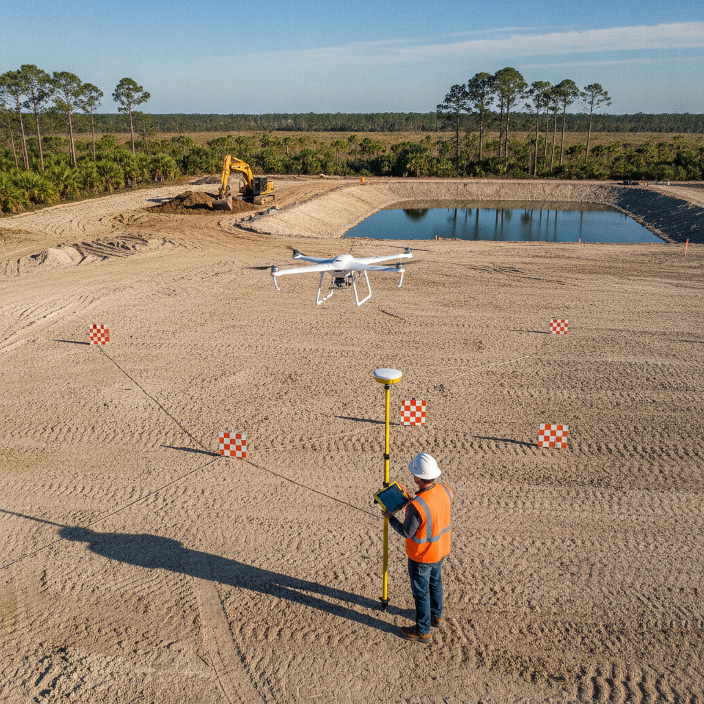
Accuracy and the Role of Ground Control
Achieving high accuracy in drone surveys requires the use of Ground Control Points (GCPs) and advanced positioning systems like RTK/PPK. GCPs are physical markers on the ground that enhance the precision of aerial data, while RTK/PPK systems provide real-time kinematic corrections, ensuring data accuracy comparable to traditional surveys.
Benefits of Drone Surveys
Drone surveys offer numerous advantages, including: Speed: Rapid data collection over large areas Crew safety: Reduced need for personnel in hazardous areas Data density: High-resolution data for detailed analysis Lower cost: Reduced labor and equipment expenses Repeatability: Consistent data collection for ongoing monitoring
Limitations of Drone Surveys
Despite their benefits, drone surveys have limitations. Photogrammetry struggles with vegetation penetration, making LiDAR preferable in forested areas. Weather conditions can affect flight operations, and aerial data cannot replace a licensed surveyor’s certified boundary. Compliance with FAA Part 107 rules and Florida-specific regulations is essential for legal operations.
Drone Data Integration with Civil 3D and GIS
Drone data seamlessly integrates with Civil 3D and GIS platforms, enhancing project planning and execution. These tools allow engineers to visualize and analyze site conditions, optimize designs, and ensure compliance with zoning and permitting requirements.
RSP Engineers’ Approach to Drone Surveys
At RSP Engineers, we leverage drone technology to enhance our site development services. Our team integrates drone data with traditional methods to provide comprehensive solutions tailored to each project’s unique needs. We ensure compliance with all permitting and zoning regulations, delivering accurate and actionable insights for our clients.
Common Issues in Drone Surveys
Common challenges in drone surveys include dealing with dense vegetation, adverse weather conditions, and ensuring data accuracy. At RSP Engineers, we address these issues by selecting the appropriate technology for each site, using advanced positioning systems, and adhering to strict operational protocols.
Contact RSP Engineers
For expert guidance on integrating drone surveys into your land development projects, contact RSP Engineers. Our team provides comprehensive site development solutions, ensuring compliance with all permitting and zoning requirements. Let us help you optimize your project with cutting-edge technology.
Conclusion
Drone surveys are revolutionizing land development in Florida by providing efficient, accurate, and cost-effective solutions. While they offer numerous benefits, understanding their limitations and ensuring compliance with FAA and local regulations is crucial. By integrating drone data with Civil 3D and GIS, engineers can enhance project planning and execution, ultimately leading to successful project outcomes.
FAQs
-
Photogrammetry uses images to create 3D models, while LiDAR uses laser pulses for precise elevation data, making it better for penetrating vegetation.
-
With the use of Ground Control Points (GCPs) and RTK/PPK systems, drone surveys can achieve high accuracy, comparable to traditional methods.
-
While drones provide valuable data, they cannot replace a licensed surveyor’s certified boundary survey, which is required for legal documentation.