
How to Read and Interpret Florida’s Land Use Maps
Learn how to read Florida’s Future Land Use Map (FLUM) for successful site development. Our civil engineering guide covers zoning, overlays, and permitting.
Understanding the Future Land Use Map (FLUM) vs. Zoning Map
One of the most common points of confusion in Florida land development is the distinction between the Future Land Use Map (FLUM) and the Zoning Map. While they work together, they serve different purposes. The FLUM is a policy document, part of a municipality’s Comprehensive Plan, that outlines the intended future use of land—it’s the long-range vision. It dictates the general type of development allowed, such as residential, commercial, or industrial, and establishes maximum development density (for residential) or intensity (for non-residential). The Zoning Map, on the other hand, is the implementation tool. It provides the specific, legally enforceable regulations for how a property can be used today. This includes details like building setbacks, height limits, parking requirements, and landscaping standards. A property’s zoning must be consistent with its FLUM designation. If you want to build a commercial project, the property must not only have a commercial zoning category but also a corresponding commercial land use designation on the FLUM. A mismatch between the two is a major red flag that often requires a lengthy amendment process.
Decoding Land Use Categories and Designations
Key Differences: Future Land Use vs. Zoning Regulations
| Feature | Future Land Use Map (FLUM) | Zoning Map |
|---|---|---|
| Purpose | Long-range policy guide for future growth and development patterns. | Legally enforceable regulations for current property use and development standards. |
| Governing Document | Local Government Comprehensive Plan. | Municipal or County Land Development Code / Zoning Ordinance. |
| Level of Detail | Broad categories (e.g., Commercial, Low-Density Residential). Governs density and intensity. | Specific districts (e.g., C-1, R-1A). Governs setbacks, height, parking, specific uses. |
| Amendment Process | Requires a formal Comprehensive Plan Amendment. Often a lengthy, multi-stage process with public hearings. | Requires a rezoning application. Typically a shorter process than a FLUM amendment but still requires hearings. |
| Legal Hierarchy | Zoning must be consistent with the FLUM. The FLUM is the controlling document. | Implements the vision of the FLUM. Cannot permit a use that is inconsistent with the land use designation. |
| Typical Information | General type of use (Residential, Commercial), maximum units per acre, or maximum Floor Area Ratio (FAR). | Specific permitted uses, building dimensions, parking ratios, landscaping rules, signage regulations. |
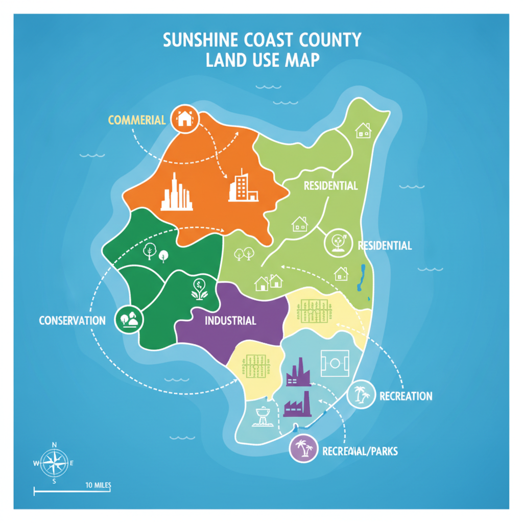
Florida’s land use maps use a color-coded system to represent different categories. While specific colors and names can vary slightly between counties and cities, the core concepts are consistent. Common categories include Residential, Commercial, Office, Industrial, Agricultural, and Conservation. Within these broad categories are more specific designations that control the scale of development. For example, a Residential category might have sub-designations like ‘Low-Density Residential’ (e.g., 1-4 units/acre) and ‘High-Density Residential’ (e.g., 15+ units/acre) for multifamily development. Interpreting these requires looking beyond the label. A ‘Commercial’ designation might allow for retail, but could it also permit a hotel or a gas station? The answer lies in the text of the Comprehensive Plan, which defines the allowable uses, maximum Floor Area Ratio (FAR), and other performance standards for each designation. A thorough due diligence process always involves cross-referencing the map with the plan’s text to understand the full scope of development rights and restrictions associated with a parcel.
The Critical Role of Overlays and Special Districts
Adding another layer of complexity are overlay districts and special planning areas. These are geographical areas that impose additional—or sometimes alternative—regulations on top of the underlying land use and zoning designations. They are created to address unique local conditions or achieve specific planning goals. Common examples in Florida include Coastal High Hazard Areas, historic preservation districts, airport compatibility zones, and Community Redevelopment Agency (CRA) districts. When analyzing a property, it is crucial to identify all applicable overlays. An overlay can significantly impact a project by introducing stricter building standards, limiting height, requiring specific architectural styles, or altering stormwater management criteria. For instance, a property with a commercial land use designation located within a historic overlay district will face design reviews and material restrictions that a similar property outside the district would not. Ignoring these regulatory constraints can derail a project during the agency review process.
Integrating Utility and Infrastructure Analysis with Land Use
A favorable land use designation is only valuable if the site can be serviced by adequate public infrastructure. A key part of reading a land use map is cross-referencing it with the availability of essential utilities and transportation access. The Comprehensive Plan often includes elements that map out future water, sewer, and roadway improvements. A civil engineering analysis must confirm if a parcel has access to municipal water and sewer lines with sufficient infrastructure capacity to support the proposed development’s density or intensity. Florida’s concurrency requirements mandate that adequate public facilities are available concurrent with the impacts of development. This means a project cannot move forward if local roads, schools, or utilities cannot handle the additional load. Therefore, analyzing the FLUM must be paired with a practical assessment of existing utility coordination needs and planned capital improvements. A parcel designated for high-density residential is not feasible if the nearest sewer main is a mile away and there are no plans to extend it.
Navigating the Comprehensive Plan and FLUM Amendments
What happens when your proposed project doesn’t align with the property’s current FLUM designation? The path forward is a Comprehensive Plan amendment, often referred to as a FLUM amendment. This is a formal, quasi-judicial process to change a property’s land use designation. It is a significant undertaking that requires extensive documentation, traffic and environmental studies, public hearings before the local planning agency and elected officials, and sometimes state-level review. The success of a FLUM amendment depends on demonstrating that the proposed change is consistent with the overall goals of the Comprehensive Plan, compatible with surrounding land uses, and serves a public interest. This process requires a deep understanding of local politics, planning principles, and the technical requirements for permit submittals. It is a strategic endeavor that should only be pursued after a thorough feasibility analysis, as it involves substantial time and financial investment with no guarantee of approval.
From Land Use to Site Plan: The Permitting Pathway
Understanding the land use map is the foundational first step in the entire permitting pathway. Once you confirm the FLUM designation supports your project concept, the focus shifts to the zoning code to develop a compliant Site plan design. The land use sets the ‘what’ (e.g., multifamily residential), while zoning dictates the ‘how’ (e.g., 30-foot setbacks, 50-foot height limit, 1.5 parking spaces per unit). Every element of the site plan, from building placement and parking layout to drainage design and landscaping, must adhere to these zoning regulations. This initial land use analysis informs the entire project scope and budget. It helps identify potential needs for variances, special exceptions, or a full rezoning application. A clear understanding of the property’s entitlements, as defined by the FLUM and implemented by zoning, allows a Professional Engineer to create a design that navigates the regulatory landscape efficiently, minimizing costly redesigns and streamlining the path to securing development permits.
RSP Engineers’ Approach to Land Use Analysis and Due Diligence
At RSP Engineers, our process begins with a comprehensive due diligence phase where we meticulously analyze the Future Land Use Map and corresponding Comprehensive Plan text. We don’t just look at the color on the map; we dive deep into the associated policies, objectives, and performance standards. Our team of Florida Licensed Engineers cross-references the FLUM with current zoning, infrastructure maps, and environmental data to provide clients with a holistic understanding of a property’s potential and its constraints. This initial analysis forms the bedrock of our strategy. We identify any inconsistencies that may require a FLUM amendment or rezoning and advise on the likelihood of success. By flagging potential hurdles related to zoning compliance, utility availability, or stormwater management early on, we empower our clients to make informed investment decisions and develop a clear, strategic roadmap for navigating the complex Florida permitting process.
Common Pitfalls in Interpreting Florida Land Use Maps
Even experienced developers can encounter issues when interpreting land use regulations. Some of the most common pitfalls we see include: Confusing Land Use with Zoning: Assuming a property is ready for development based on its zoning category alone, without verifying that it is consistent with the FLUM. Ignoring Overlay Districts: Overlooking additional regulations from overlays like historic districts or coastal zones, leading to major design changes and delays late in the process. Underestimating the Amendment Process: Believing a FLUM amendment is a simple administrative task, rather than a complex, time-consuming, and often political process. Failing to Verify Utility Capacity: Assuming that proximity to a utility line guarantees service, without performing the necessary utility coordination to confirm capacity for the proposed project. Misinterpreting Density Calculations: Incorrectly calculating allowable residential density by not accounting for non-developable areas like wetlands or conservation easements, leading to an oversized project concept.
Partner with RSP for Expert Land Use and Site Development Guidance
Navigating Florida’s complex web of land use regulations requires specialized expertise. The team at RSP Engineers provides the in-depth analysis and strategic guidance necessary to turn your development vision into a reality. We specialize in comprehensive due diligence, feasibility studies, and navigating the entitlement process. From initial site feasibility analysis and zoning compliance reviews to managing the complexities of a FLUM amendment, we are your partners in building a successful project from the ground up.
Strategic Site Selection Starts with the Land Use Map
In conclusion, the Florida Land Use Map is the foundational document that governs all land development. A thorough and accurate interpretation is not just a preliminary step but a critical component of risk management and strategic planning. Understanding the interplay between the FLUM, zoning, overlay districts, and infrastructure is essential for avoiding costly missteps. By prioritizing a detailed land use analysis, developers can ensure their projects are built on a solid regulatory foundation, streamlining the path to successful permitting and construction.
FAQs
-
The first step is to conduct a feasibility study with a qualified civil engineering firm. This study will assess the viability of a Future Land Use Map amendment and/or a rezoning. It involves analyzing the Comprehensive Plan, surrounding land uses, political climate, and potential impacts to determine a strategic path forward.
-
A FLUM amendment is a significant process. Depending on the jurisdiction and complexity, it can take anywhere from 6 to 18 months. The process involves multiple steps, including staff reviews, community meetings, planning board hearings, and final adoption by the city or county commission, with potential for agency review at the state level.
-
Yes, it’s quite common. A single large parcel can be ‘split-designated’ with different land use categories on different portions. Furthermore, any property can be subject to one or more overlay districts (e. g. , a commercial property within both a floodplain and a CRA district), each adding its own layer of regulations.